Blog
Latest insights on location technology in climate change, emergency management and more.
 https://spatialvision.com.au/wp-content/uploads/2024/01/Blog-post-tile-7.png
500
900
Jeff D
https://spatialvision.com.au/wp-content/uploads/2020/04/SV_Logo_Inline.png
Jeff D2024-01-16 11:21:062024-02-19 09:11:58Differences between ArcPy and PyQGIS
https://spatialvision.com.au/wp-content/uploads/2024/01/Blog-post-tile-7.png
500
900
Jeff D
https://spatialvision.com.au/wp-content/uploads/2020/04/SV_Logo_Inline.png
Jeff D2024-01-16 11:21:062024-02-19 09:11:58Differences between ArcPy and PyQGIS https://spatialvision.com.au/wp-content/uploads/2024/01/Blog-post-tile-2.png
500
900
Jeff D
https://spatialvision.com.au/wp-content/uploads/2020/04/SV_Logo_Inline.png
Jeff D2024-01-15 12:31:282024-03-21 14:31:18The Role of Geospatial Intelligence in Building Resilience
https://spatialvision.com.au/wp-content/uploads/2024/01/Blog-post-tile-2.png
500
900
Jeff D
https://spatialvision.com.au/wp-content/uploads/2020/04/SV_Logo_Inline.png
Jeff D2024-01-15 12:31:282024-03-21 14:31:18The Role of Geospatial Intelligence in Building Resilience https://spatialvision.com.au/wp-content/uploads/2023/09/Blog-post-tile-5.png
500
900
Jeff D
https://spatialvision.com.au/wp-content/uploads/2020/04/SV_Logo_Inline.png
Jeff D2023-09-08 12:31:412023-12-20 11:04:23Geospatial technology essential to early warning weather systems
https://spatialvision.com.au/wp-content/uploads/2023/09/Blog-post-tile-5.png
500
900
Jeff D
https://spatialvision.com.au/wp-content/uploads/2020/04/SV_Logo_Inline.png
Jeff D2023-09-08 12:31:412023-12-20 11:04:23Geospatial technology essential to early warning weather systems https://spatialvision.com.au/wp-content/uploads/2023/08/Blog-post-tile-2.png
500
900
Jeff D
https://spatialvision.com.au/wp-content/uploads/2020/04/SV_Logo_Inline.png
Jeff D2023-08-25 10:49:452023-12-20 11:03:56Transform your Geospatial Capability with a Strategy
https://spatialvision.com.au/wp-content/uploads/2023/08/Blog-post-tile-2.png
500
900
Jeff D
https://spatialvision.com.au/wp-content/uploads/2020/04/SV_Logo_Inline.png
Jeff D2023-08-25 10:49:452023-12-20 11:03:56Transform your Geospatial Capability with a Strategy https://spatialvision.com.au/wp-content/uploads/2023/07/Blog-post-tile-1-1.png
500
900
Jeff D
https://spatialvision.com.au/wp-content/uploads/2020/04/SV_Logo_Inline.png
Jeff D2023-07-10 12:45:182024-02-12 12:21:46Cricket and geospatial technology: a winning partnership?
https://spatialvision.com.au/wp-content/uploads/2023/07/Blog-post-tile-1-1.png
500
900
Jeff D
https://spatialvision.com.au/wp-content/uploads/2020/04/SV_Logo_Inline.png
Jeff D2023-07-10 12:45:182024-02-12 12:21:46Cricket and geospatial technology: a winning partnership?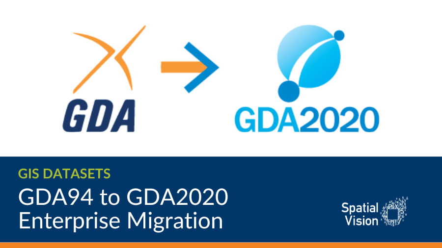 https://spatialvision.com.au/wp-content/uploads/2023/05/DCM-Blog-Covers.png
506
900
Jeff D
https://spatialvision.com.au/wp-content/uploads/2020/04/SV_Logo_Inline.png
Jeff D2023-05-30 09:34:552023-12-20 11:03:02GDA94 to GDA2020 enterprise migration
https://spatialvision.com.au/wp-content/uploads/2023/05/DCM-Blog-Covers.png
506
900
Jeff D
https://spatialvision.com.au/wp-content/uploads/2020/04/SV_Logo_Inline.png
Jeff D2023-05-30 09:34:552023-12-20 11:03:02GDA94 to GDA2020 enterprise migration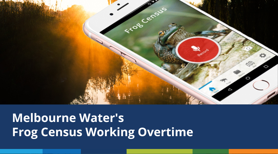 https://spatialvision.com.au/wp-content/uploads/2023/03/Blog-post-tile-3.png
500
900
Jeff D
https://spatialvision.com.au/wp-content/uploads/2020/04/SV_Logo_Inline.png
Jeff D2023-03-17 14:14:502023-12-20 11:09:15Melbourne Water’s Frog Census Working Overtime
https://spatialvision.com.au/wp-content/uploads/2023/03/Blog-post-tile-3.png
500
900
Jeff D
https://spatialvision.com.au/wp-content/uploads/2020/04/SV_Logo_Inline.png
Jeff D2023-03-17 14:14:502023-12-20 11:09:15Melbourne Water’s Frog Census Working Overtime https://spatialvision.com.au/wp-content/uploads/2023/03/Blog-post-tile-1.png
500
900
Jeff D
https://spatialvision.com.au/wp-content/uploads/2020/04/SV_Logo_Inline.png
Jeff D2023-03-03 09:52:152023-12-20 11:09:24Building Resilience in the Pacific
https://spatialvision.com.au/wp-content/uploads/2023/03/Blog-post-tile-1.png
500
900
Jeff D
https://spatialvision.com.au/wp-content/uploads/2020/04/SV_Logo_Inline.png
Jeff D2023-03-03 09:52:152023-12-20 11:09:24Building Resilience in the Pacific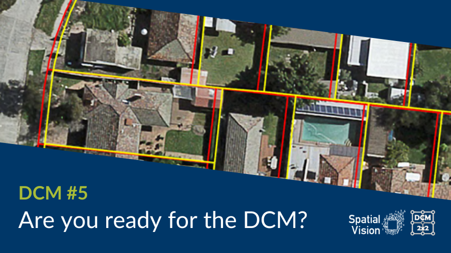 https://spatialvision.com.au/wp-content/uploads/2022/11/DCM-Blog-Covers-3.png
506
900
Jeff D
https://spatialvision.com.au/wp-content/uploads/2020/04/SV_Logo_Inline.png
Jeff D2022-11-25 16:01:272023-12-20 11:14:02Are you ready for DCM?
https://spatialvision.com.au/wp-content/uploads/2022/11/DCM-Blog-Covers-3.png
506
900
Jeff D
https://spatialvision.com.au/wp-content/uploads/2020/04/SV_Logo_Inline.png
Jeff D2022-11-25 16:01:272023-12-20 11:14:02Are you ready for DCM?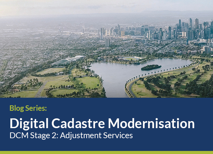
Spatial Vision and partners are leading Stage 2 of the Victorian Government’s $45 million investment to upgrade the State’s digital cadastre using survey observations. Follow our journey here.

To increase our overall impact, we are committed to supporting the 17 UN Sustainable Development Goals and are aligning our operations, service delivery and client partnerships with this globally-recognised initiative. Follow our journey here.

 https://spatialvision.com.au/wp-content/uploads/2022/09/Blog-post-tile.png
500
900
Jeff D
https://spatialvision.com.au/wp-content/uploads/2020/04/SV_Logo_Inline.png
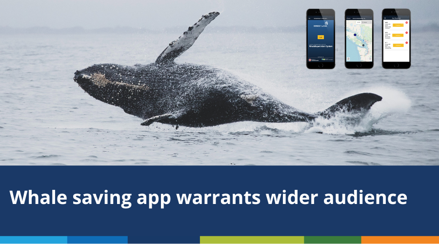
Jeff D2022-10-04 10:04:522023-12-20 11:15:14Whale saving technology warrants wider application
https://spatialvision.com.au/wp-content/uploads/2022/09/Blog-post-tile.png
500
900
Jeff D
https://spatialvision.com.au/wp-content/uploads/2020/04/SV_Logo_Inline.png
Jeff D2022-10-04 10:04:522023-12-20 11:15:14Whale saving technology warrants wider application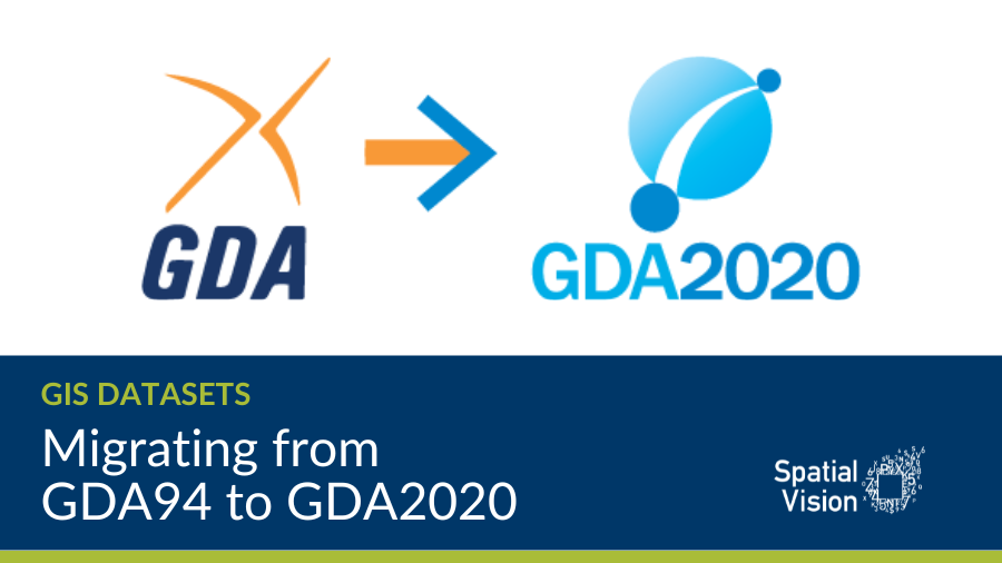 https://spatialvision.com.au/wp-content/uploads/2022/09/DCM-Blog-Covers-4.png
506
900
Jeff D
https://spatialvision.com.au/wp-content/uploads/2020/04/SV_Logo_Inline.png
Jeff D2022-09-02 13:38:032023-12-20 11:15:40Migrating from GDA94 to GDA2020
https://spatialvision.com.au/wp-content/uploads/2022/09/DCM-Blog-Covers-4.png
506
900
Jeff D
https://spatialvision.com.au/wp-content/uploads/2020/04/SV_Logo_Inline.png
Jeff D2022-09-02 13:38:032023-12-20 11:15:40Migrating from GDA94 to GDA2020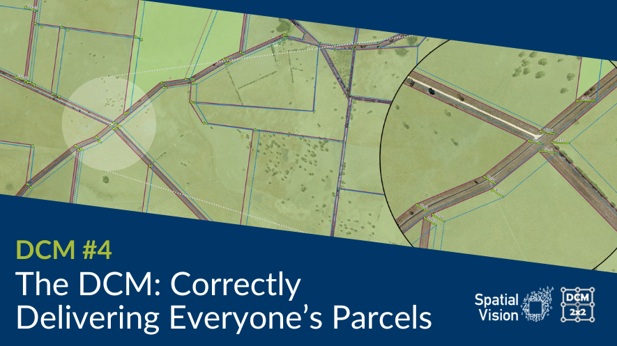 https://spatialvision.com.au/wp-content/uploads/2022/07/DCM-Blog-4.png
497
885
Jeff D
https://spatialvision.com.au/wp-content/uploads/2020/04/SV_Logo_Inline.png
Jeff D2022-08-08 09:49:112023-12-20 11:16:15The DCM Project – Correctly Delivering Everyone’s Parcels
https://spatialvision.com.au/wp-content/uploads/2022/07/DCM-Blog-4.png
497
885
Jeff D
https://spatialvision.com.au/wp-content/uploads/2020/04/SV_Logo_Inline.png
Jeff D2022-08-08 09:49:112023-12-20 11:16:15The DCM Project – Correctly Delivering Everyone’s Parcels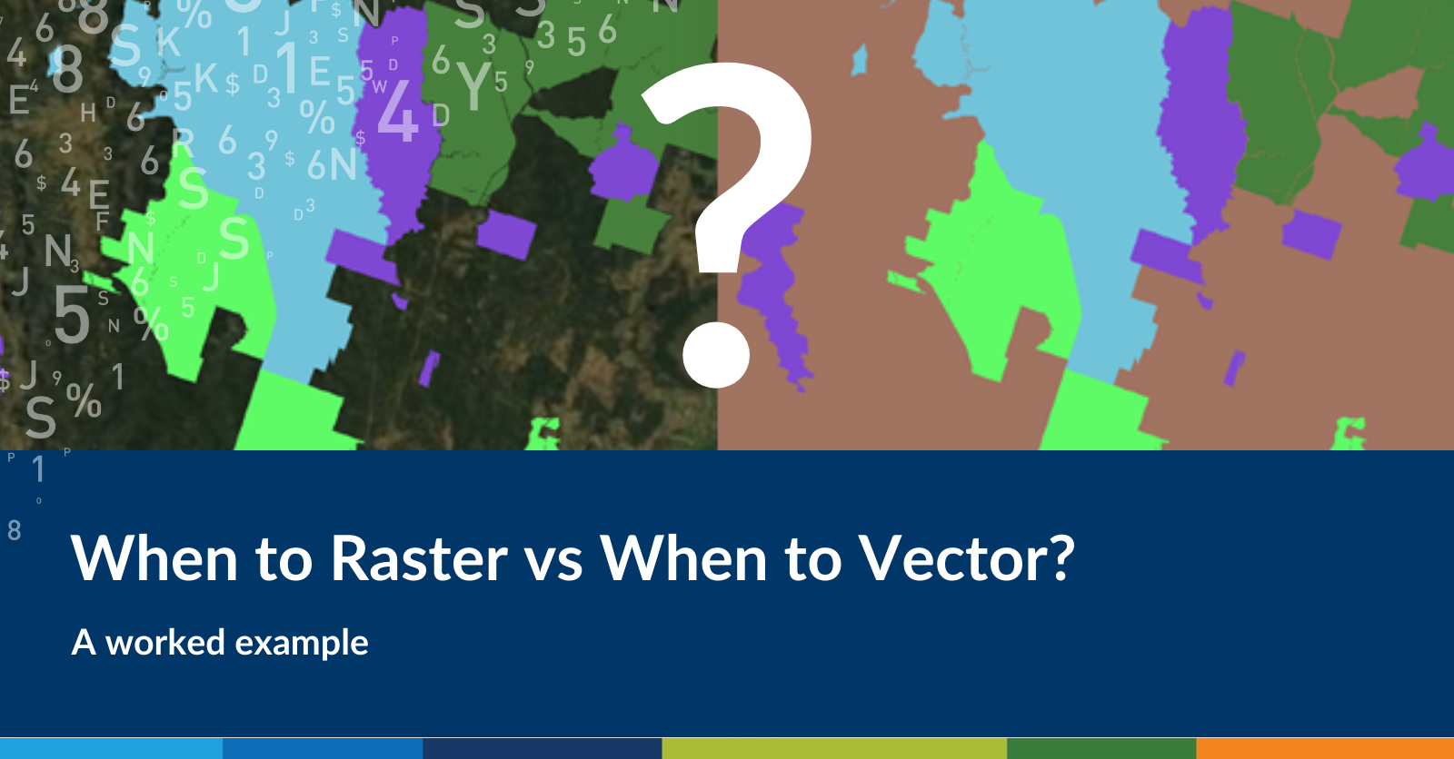 https://spatialvision.com.au/wp-content/uploads/2022/05/Raster-Vector-Blog-Cover-Image.png
836
1600
Harmen Romeijn
https://spatialvision.com.au/wp-content/uploads/2020/04/SV_Logo_Inline.png
Harmen Romeijn2022-05-04 23:57:302023-12-20 11:16:48When to Raster vs When to Vector? A worked example
https://spatialvision.com.au/wp-content/uploads/2022/05/Raster-Vector-Blog-Cover-Image.png
836
1600
Harmen Romeijn
https://spatialvision.com.au/wp-content/uploads/2020/04/SV_Logo_Inline.png
Harmen Romeijn2022-05-04 23:57:302023-12-20 11:16:48When to Raster vs When to Vector? A worked example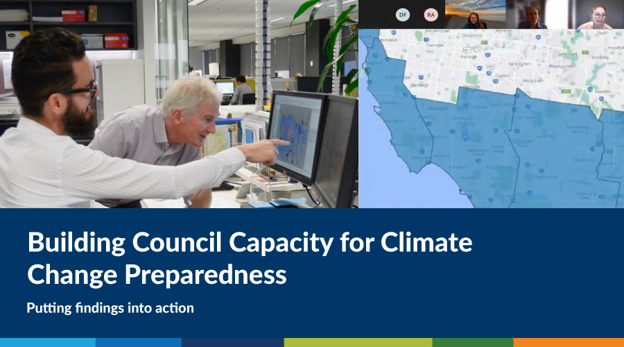 https://spatialvision.com.au/wp-content/uploads/2021/12/Mentoring-blog-cover-2.png
500
900
Rhiannan Mundana
https://spatialvision.com.au/wp-content/uploads/2020/04/SV_Logo_Inline.png
Rhiannan Mundana2021-12-22 12:46:372023-12-20 11:17:04Building Council Capacity for Climate Change Preparedness
https://spatialvision.com.au/wp-content/uploads/2021/12/Mentoring-blog-cover-2.png
500
900
Rhiannan Mundana
https://spatialvision.com.au/wp-content/uploads/2020/04/SV_Logo_Inline.png
Rhiannan Mundana2021-12-22 12:46:372023-12-20 11:17:04Building Council Capacity for Climate Change Preparedness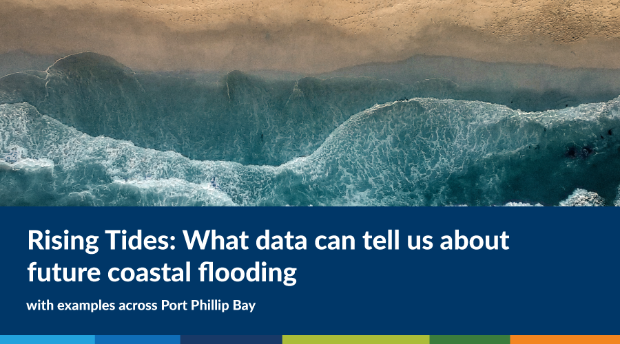 https://spatialvision.com.au/wp-content/uploads/2021/12/RisingTides-Blog-cover.png
500
900
David Pepin
https://spatialvision.com.au/wp-content/uploads/2020/04/SV_Logo_Inline.png
David Pepin2021-12-16 16:27:282023-12-20 11:17:13Rising Tides: What data can tell us about future coastal flooding
https://spatialvision.com.au/wp-content/uploads/2021/12/RisingTides-Blog-cover.png
500
900
David Pepin
https://spatialvision.com.au/wp-content/uploads/2020/04/SV_Logo_Inline.png
David Pepin2021-12-16 16:27:282023-12-20 11:17:13Rising Tides: What data can tell us about future coastal flooding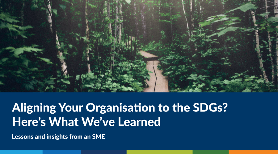 https://spatialvision.com.au/wp-content/uploads/2021/12/Blog-cover.png
500
900
Amelia Lazarus
https://spatialvision.com.au/wp-content/uploads/2020/04/SV_Logo_Inline.png
Amelia Lazarus2021-12-03 15:35:302023-12-20 11:17:30Aligning Your Organisation to the SDGs? Here’s What We’ve Learned
https://spatialvision.com.au/wp-content/uploads/2021/12/Blog-cover.png
500
900
Amelia Lazarus
https://spatialvision.com.au/wp-content/uploads/2020/04/SV_Logo_Inline.png
Amelia Lazarus2021-12-03 15:35:302023-12-20 11:17:30Aligning Your Organisation to the SDGs? Here’s What We’ve Learned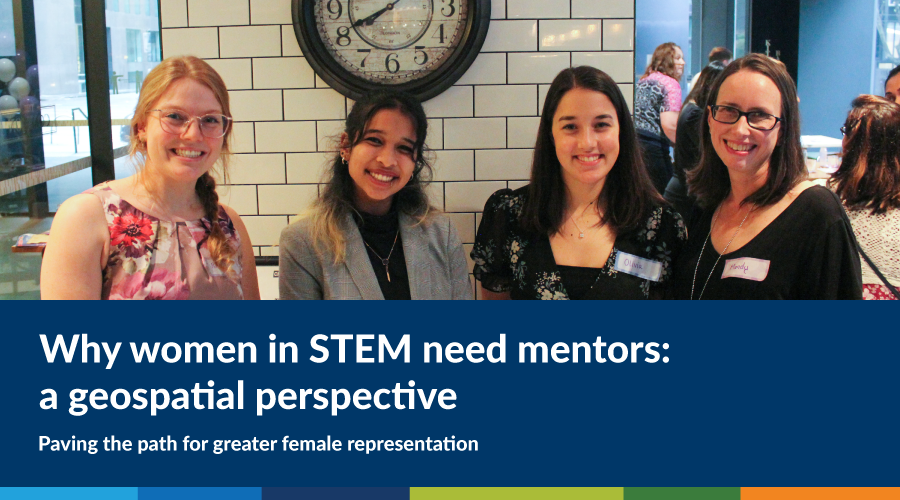 https://spatialvision.com.au/wp-content/uploads/2021/11/Women-In-Stem-blog-cover-1.png
500
900
Rhiannan Mundana
https://spatialvision.com.au/wp-content/uploads/2020/04/SV_Logo_Inline.png
Rhiannan Mundana2021-11-25 17:13:052023-12-20 11:17:41Why women in STEM need mentors – a geospatial perspective
https://spatialvision.com.au/wp-content/uploads/2021/11/Women-In-Stem-blog-cover-1.png
500
900
Rhiannan Mundana
https://spatialvision.com.au/wp-content/uploads/2020/04/SV_Logo_Inline.png
Rhiannan Mundana2021-11-25 17:13:052023-12-20 11:17:41Why women in STEM need mentors – a geospatial perspective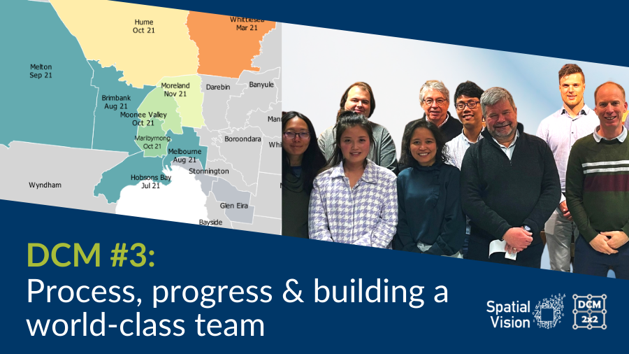 https://spatialvision.com.au/wp-content/uploads/2021/11/DCM-Blog-3-Cover.png
506
900
Jeremy Alcorn
https://spatialvision.com.au/wp-content/uploads/2020/04/SV_Logo_Inline.png
Jeremy Alcorn2021-11-17 12:30:472023-12-20 11:17:48DCM #3: Process, progress & building a world-class team
https://spatialvision.com.au/wp-content/uploads/2021/11/DCM-Blog-3-Cover.png
506
900
Jeremy Alcorn
https://spatialvision.com.au/wp-content/uploads/2020/04/SV_Logo_Inline.png
Jeremy Alcorn2021-11-17 12:30:472023-12-20 11:17:48DCM #3: Process, progress & building a world-class team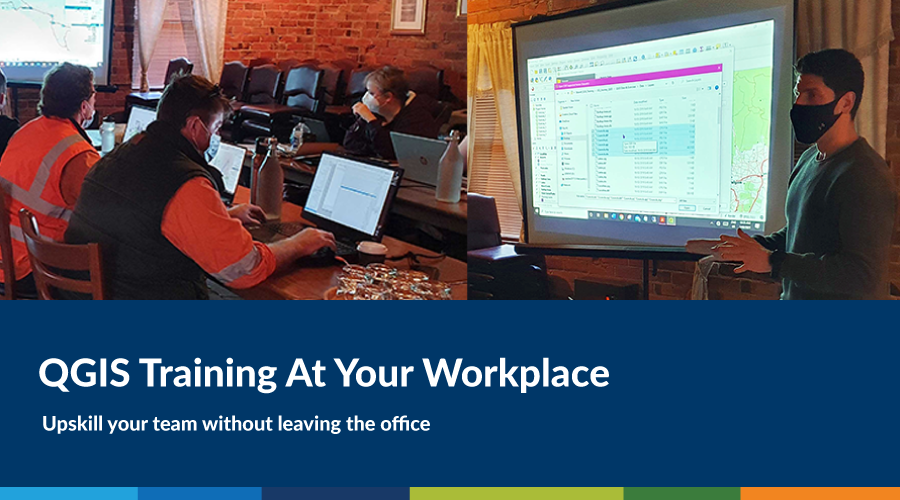 https://spatialvision.com.au/wp-content/uploads/2021/10/QGIS-Stawell-Blog-Cover-1.png
500
900
Marcel Sahyoune
https://spatialvision.com.au/wp-content/uploads/2020/04/SV_Logo_Inline.png
Marcel Sahyoune2021-10-11 10:23:262023-12-20 11:18:20QGIS Training At Your Workplace
https://spatialvision.com.au/wp-content/uploads/2021/10/QGIS-Stawell-Blog-Cover-1.png
500
900
Marcel Sahyoune
https://spatialvision.com.au/wp-content/uploads/2020/04/SV_Logo_Inline.png
Marcel Sahyoune2021-10-11 10:23:262023-12-20 11:18:20QGIS Training At Your Workplace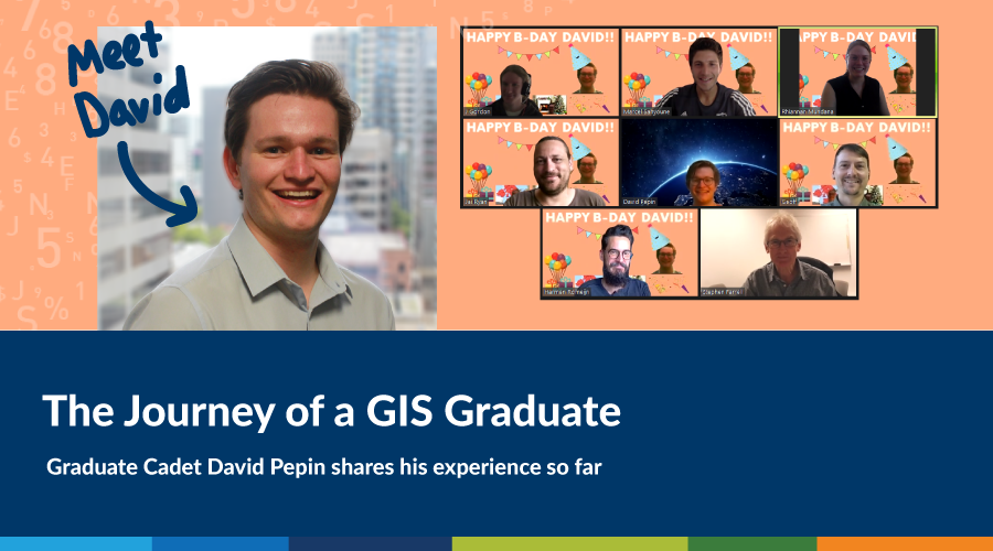 https://spatialvision.com.au/wp-content/uploads/2021/06/David-graduate-cadet-cover.png
500
900
David Pepin
https://spatialvision.com.au/wp-content/uploads/2020/04/SV_Logo_Inline.png
David Pepin2021-06-17 15:06:192023-12-20 11:20:07The Journey of a GIS Graduate: 2021 Graduate Cadet Program
https://spatialvision.com.au/wp-content/uploads/2021/06/David-graduate-cadet-cover.png
500
900
David Pepin
https://spatialvision.com.au/wp-content/uploads/2020/04/SV_Logo_Inline.png
David Pepin2021-06-17 15:06:192023-12-20 11:20:07The Journey of a GIS Graduate: 2021 Graduate Cadet Program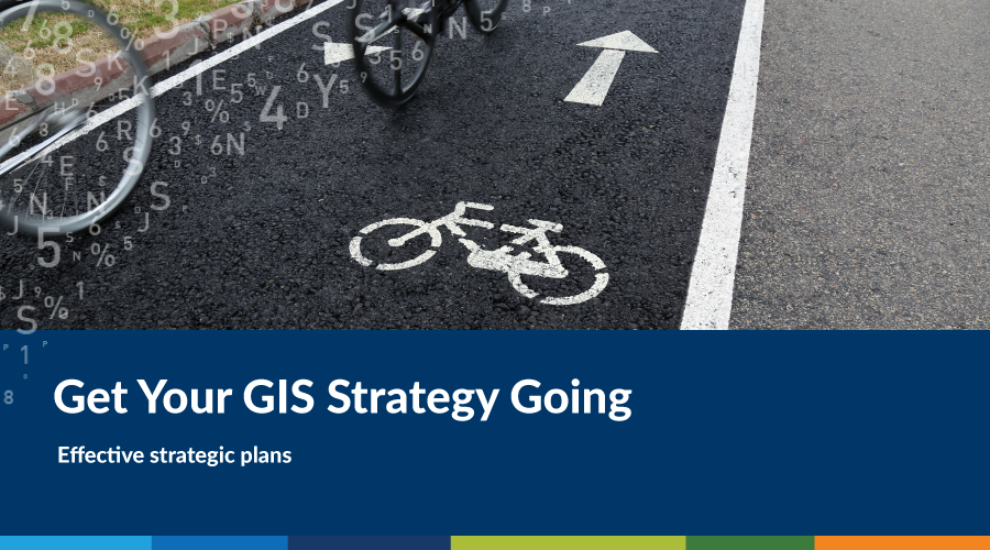 https://spatialvision.com.au/wp-content/uploads/2021/05/Blog-cover-2.png
500
900
Graeme Martin
https://spatialvision.com.au/wp-content/uploads/2020/04/SV_Logo_Inline.png
Graeme Martin2021-05-25 09:09:072023-12-20 12:05:13Get Your GIS Strategy Going
https://spatialvision.com.au/wp-content/uploads/2021/05/Blog-cover-2.png
500
900
Graeme Martin
https://spatialvision.com.au/wp-content/uploads/2020/04/SV_Logo_Inline.png
Graeme Martin2021-05-25 09:09:072023-12-20 12:05:13Get Your GIS Strategy Going https://spatialvision.com.au/wp-content/uploads/2021/05/Blog-cover.png
500
900
Graeme Martin
https://spatialvision.com.au/wp-content/uploads/2020/04/SV_Logo_Inline.png
Graeme Martin2021-05-21 19:21:292023-12-20 12:05:24SDG Business Reporting: An SME Example
https://spatialvision.com.au/wp-content/uploads/2021/05/Blog-cover.png
500
900
Graeme Martin
https://spatialvision.com.au/wp-content/uploads/2020/04/SV_Logo_Inline.png
Graeme Martin2021-05-21 19:21:292023-12-20 12:05:24SDG Business Reporting: An SME Example https://spatialvision.com.au/wp-content/uploads/2018/03/8-of-the-Best-Data-Visualisation-Platforms.jpg
506
900
Spatial Vision
https://spatialvision.com.au/wp-content/uploads/2020/04/SV_Logo_Inline.png
Spatial Vision2021-05-13 08:11:502023-12-20 12:06:008 of the Best Data Visualisation Platforms
https://spatialvision.com.au/wp-content/uploads/2018/03/8-of-the-Best-Data-Visualisation-Platforms.jpg
506
900
Spatial Vision
https://spatialvision.com.au/wp-content/uploads/2020/04/SV_Logo_Inline.png
Spatial Vision2021-05-13 08:11:502023-12-20 12:06:008 of the Best Data Visualisation Platforms https://spatialvision.com.au/wp-content/uploads/2021/03/svmaps-goes-digital-blog-cover.png
500
900
Geoff Williams
https://spatialvision.com.au/wp-content/uploads/2020/04/SV_Logo_Inline.png
Geoff Williams2021-03-12 08:33:312023-12-20 12:06:22SV Maps Goes Digital
https://spatialvision.com.au/wp-content/uploads/2021/03/svmaps-goes-digital-blog-cover.png
500
900
Geoff Williams
https://spatialvision.com.au/wp-content/uploads/2020/04/SV_Logo_Inline.png
Geoff Williams2021-03-12 08:33:312023-12-20 12:06:22SV Maps Goes Digital https://spatialvision.com.au/wp-content/uploads/2020/12/0-2020Impact-1.png
500
900
Glenn Cockerton
https://spatialvision.com.au/wp-content/uploads/2020/04/SV_Logo_Inline.png
Glenn Cockerton2020-12-18 13:58:212023-12-20 12:07:232020 Impact: Industry Trends and Developments
https://spatialvision.com.au/wp-content/uploads/2020/12/0-2020Impact-1.png
500
900
Glenn Cockerton
https://spatialvision.com.au/wp-content/uploads/2020/04/SV_Logo_Inline.png
Glenn Cockerton2020-12-18 13:58:212023-12-20 12:07:232020 Impact: Industry Trends and Developments https://spatialvision.com.au/wp-content/uploads/2020/12/0-remember-2020.png
500
900
Graeme Martin
https://spatialvision.com.au/wp-content/uploads/2020/04/SV_Logo_Inline.png
Graeme Martin2020-12-15 14:50:032023-12-20 12:07:39Remember 2020?
https://spatialvision.com.au/wp-content/uploads/2020/12/0-remember-2020.png
500
900
Graeme Martin
https://spatialvision.com.au/wp-content/uploads/2020/04/SV_Logo_Inline.png
Graeme Martin2020-12-15 14:50:032023-12-20 12:07:39Remember 2020?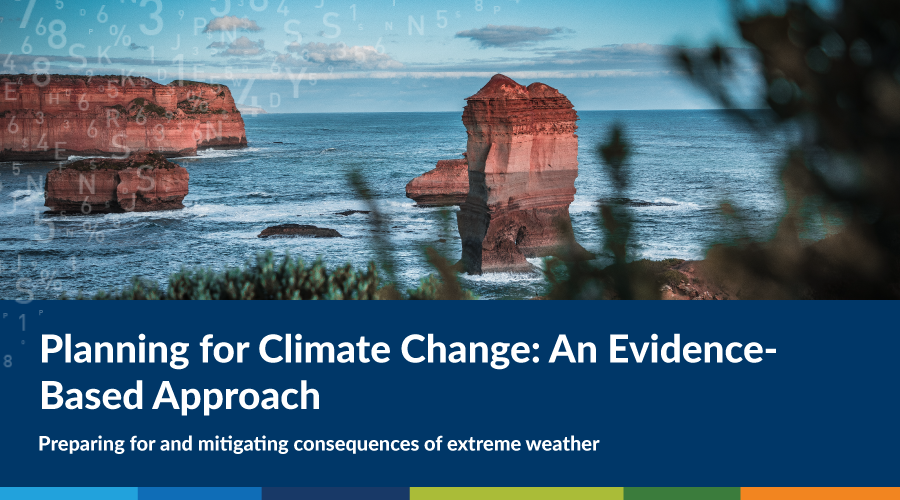 https://spatialvision.com.au/wp-content/uploads/2020/11/planningforclimatechangecover-02.png
500
900
Rhiannan Mundana
https://spatialvision.com.au/wp-content/uploads/2020/04/SV_Logo_Inline.png
Rhiannan Mundana2020-11-19 13:40:212023-12-20 12:08:32Planning for Climate Change: An Evidence-Based Approach
https://spatialvision.com.au/wp-content/uploads/2020/11/planningforclimatechangecover-02.png
500
900
Rhiannan Mundana
https://spatialvision.com.au/wp-content/uploads/2020/04/SV_Logo_Inline.png
Rhiannan Mundana2020-11-19 13:40:212023-12-20 12:08:32Planning for Climate Change: An Evidence-Based Approach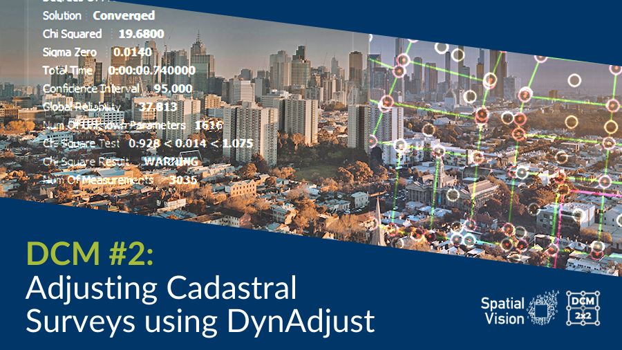 https://spatialvision.com.au/wp-content/uploads/2020/10/DCM-Blog-Cover-2.png
506
900
Jeremy Alcorn
https://spatialvision.com.au/wp-content/uploads/2020/04/SV_Logo_Inline.png
Jeremy Alcorn2020-10-26 15:55:502023-12-20 12:08:52DCM #2: Adjusting Cadastral Surveys using DynAdjust
https://spatialvision.com.au/wp-content/uploads/2020/10/DCM-Blog-Cover-2.png
506
900
Jeremy Alcorn
https://spatialvision.com.au/wp-content/uploads/2020/04/SV_Logo_Inline.png
Jeremy Alcorn2020-10-26 15:55:502023-12-20 12:08:52DCM #2: Adjusting Cadastral Surveys using DynAdjust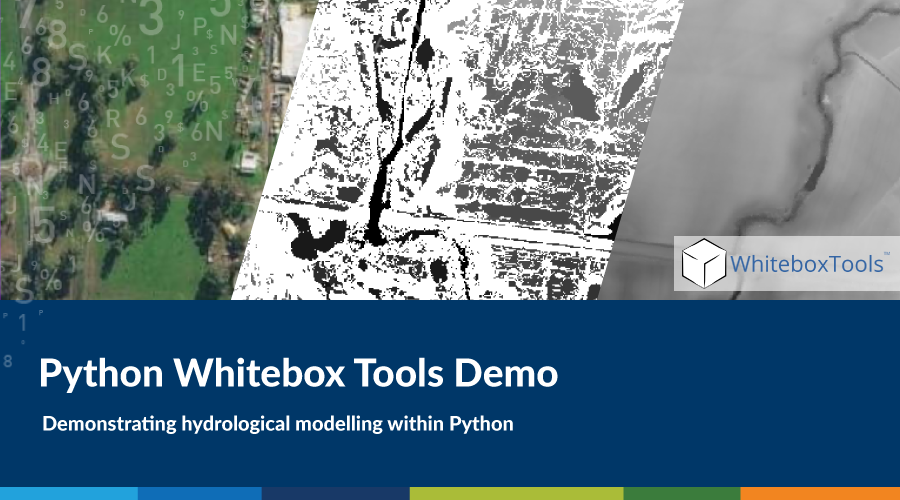 https://spatialvision.com.au/wp-content/uploads/2020/09/Python-Whitebox-cover-1.png
500
900
Spatial Vision
https://spatialvision.com.au/wp-content/uploads/2020/04/SV_Logo_Inline.png
Spatial Vision2020-09-30 05:07:172023-12-20 12:09:01Python Whitebox Tools Demo
https://spatialvision.com.au/wp-content/uploads/2020/09/Python-Whitebox-cover-1.png
500
900
Spatial Vision
https://spatialvision.com.au/wp-content/uploads/2020/04/SV_Logo_Inline.png
Spatial Vision2020-09-30 05:07:172023-12-20 12:09:01Python Whitebox Tools Demo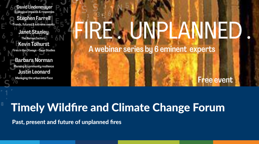 https://spatialvision.com.au/wp-content/uploads/2020/09/Climate-blog-cover.png
500
900
Stephen Farrell
https://spatialvision.com.au/wp-content/uploads/2020/04/SV_Logo_Inline.png
Stephen Farrell2020-09-21 16:54:242023-12-20 12:09:26Timely Wildfire and Climate Change Forum
https://spatialvision.com.au/wp-content/uploads/2020/09/Climate-blog-cover.png
500
900
Stephen Farrell
https://spatialvision.com.au/wp-content/uploads/2020/04/SV_Logo_Inline.png
Stephen Farrell2020-09-21 16:54:242023-12-20 12:09:26Timely Wildfire and Climate Change Forum https://spatialvision.com.au/wp-content/uploads/2020/09/gisjourneyonlinecover-01.png
500
900
Marcel Sahyoune
https://spatialvision.com.au/wp-content/uploads/2020/04/SV_Logo_Inline.png
Marcel Sahyoune2020-09-08 18:02:232023-12-20 12:09:34The Online GIS Journey
https://spatialvision.com.au/wp-content/uploads/2020/09/gisjourneyonlinecover-01.png
500
900
Marcel Sahyoune
https://spatialvision.com.au/wp-content/uploads/2020/04/SV_Logo_Inline.png
Marcel Sahyoune2020-09-08 18:02:232023-12-20 12:09:34The Online GIS Journey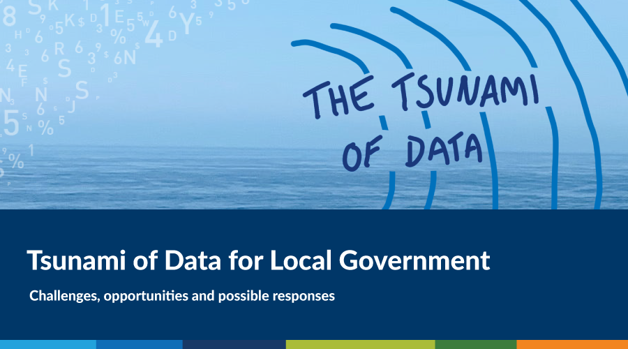 https://spatialvision.com.au/wp-content/uploads/2020/07/SSSI-Webinar-Blog-cover-nogm-1.png
500
900
Graeme Martin
https://spatialvision.com.au/wp-content/uploads/2020/04/SV_Logo_Inline.png
Graeme Martin2020-08-04 15:06:062023-12-20 12:10:09Tsunami of Data for Local Government
https://spatialvision.com.au/wp-content/uploads/2020/07/SSSI-Webinar-Blog-cover-nogm-1.png
500
900
Graeme Martin
https://spatialvision.com.au/wp-content/uploads/2020/04/SV_Logo_Inline.png
Graeme Martin2020-08-04 15:06:062023-12-20 12:10:09Tsunami of Data for Local Government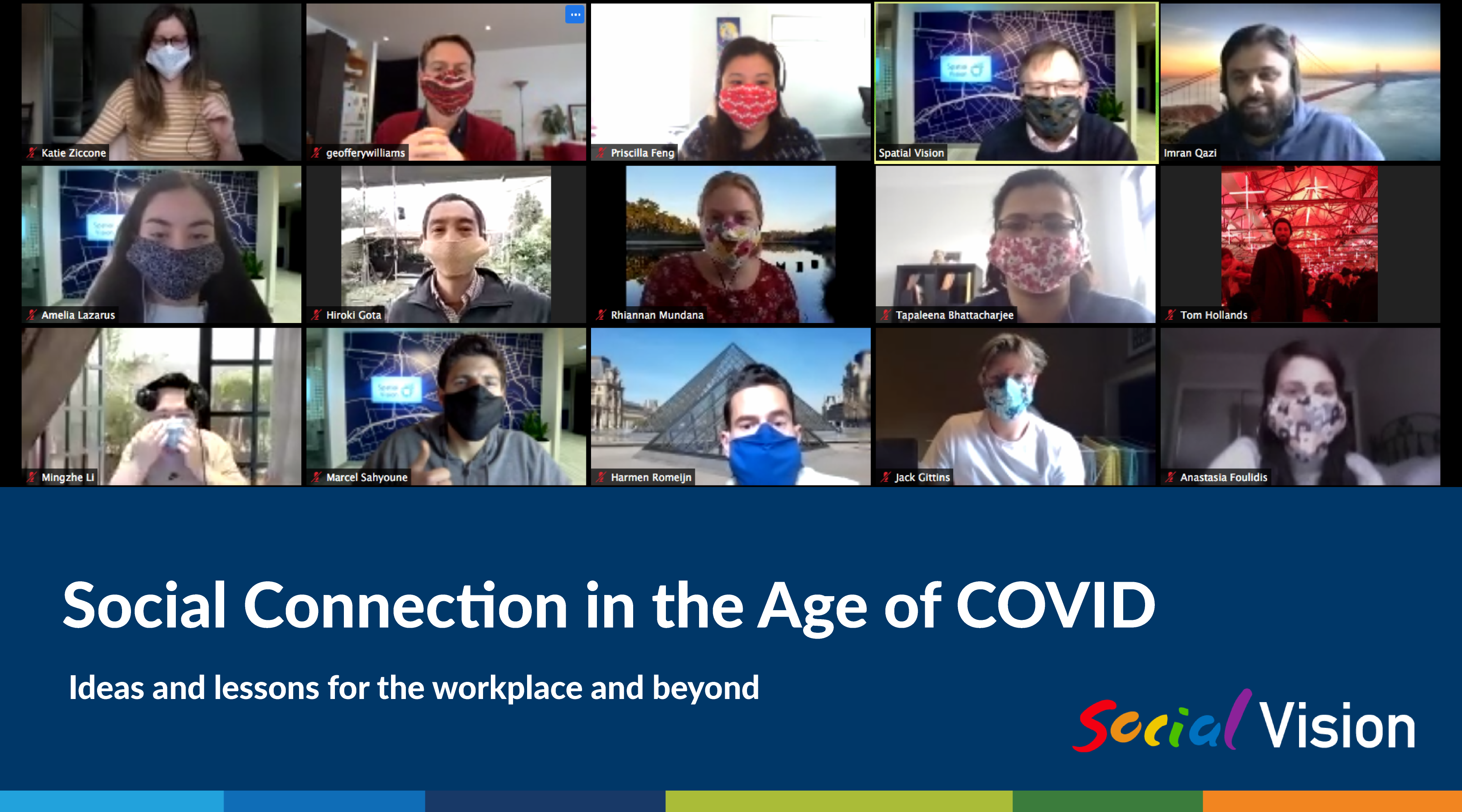 https://spatialvision.com.au/wp-content/uploads/2020/07/Blog-cover-01.png
2084
3750
Katie Ziccone
https://spatialvision.com.au/wp-content/uploads/2020/04/SV_Logo_Inline.png
Katie Ziccone2020-07-30 07:52:262023-12-20 12:10:18Social Connection in the Age of COVID: Ideas and lessons for the workplace and beyond
https://spatialvision.com.au/wp-content/uploads/2020/07/Blog-cover-01.png
2084
3750
Katie Ziccone
https://spatialvision.com.au/wp-content/uploads/2020/04/SV_Logo_Inline.png
Katie Ziccone2020-07-30 07:52:262023-12-20 12:10:18Social Connection in the Age of COVID: Ideas and lessons for the workplace and beyond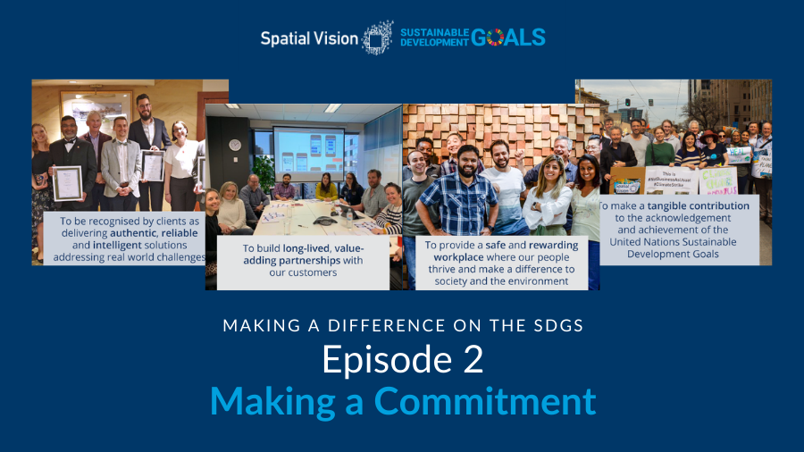 https://spatialvision.com.au/wp-content/uploads/2020/07/SDGs-Ep-2-Cover-2.png
506
900
Amelia Lazarus
https://spatialvision.com.au/wp-content/uploads/2020/04/SV_Logo_Inline.png
Amelia Lazarus2020-07-22 08:03:292023-12-20 12:10:27Ep 2: Making a Commitment
https://spatialvision.com.au/wp-content/uploads/2020/07/SDGs-Ep-2-Cover-2.png
506
900
Amelia Lazarus
https://spatialvision.com.au/wp-content/uploads/2020/04/SV_Logo_Inline.png
Amelia Lazarus2020-07-22 08:03:292023-12-20 12:10:27Ep 2: Making a Commitment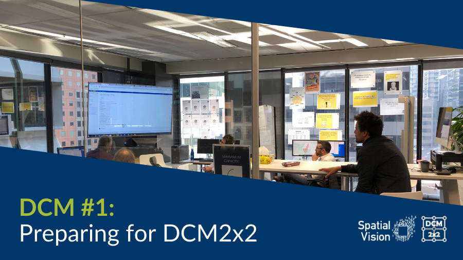 https://spatialvision.com.au/wp-content/uploads/2020/06/BlogCover1.png
506
900
Jeremy Alcorn
https://spatialvision.com.au/wp-content/uploads/2020/04/SV_Logo_Inline.png
Jeremy Alcorn2020-06-19 17:45:232023-12-20 12:10:53DCM #1: Preparing for DCM2x2
https://spatialvision.com.au/wp-content/uploads/2020/06/BlogCover1.png
506
900
Jeremy Alcorn
https://spatialvision.com.au/wp-content/uploads/2020/04/SV_Logo_Inline.png
Jeremy Alcorn2020-06-19 17:45:232023-12-20 12:10:53DCM #1: Preparing for DCM2x2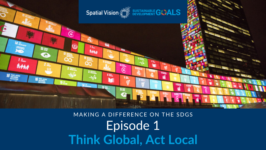 https://spatialvision.com.au/wp-content/uploads/2020/07/SDGs-Ep-1-Cover.png
506
900
Graeme Martin
https://spatialvision.com.au/wp-content/uploads/2020/04/SV_Logo_Inline.png
Graeme Martin2020-04-27 10:33:142023-12-20 12:12:12Ep 1: Think Global, Act Local
https://spatialvision.com.au/wp-content/uploads/2020/07/SDGs-Ep-1-Cover.png
506
900
Graeme Martin
https://spatialvision.com.au/wp-content/uploads/2020/04/SV_Logo_Inline.png
Graeme Martin2020-04-27 10:33:142023-12-20 12:12:12Ep 1: Think Global, Act Local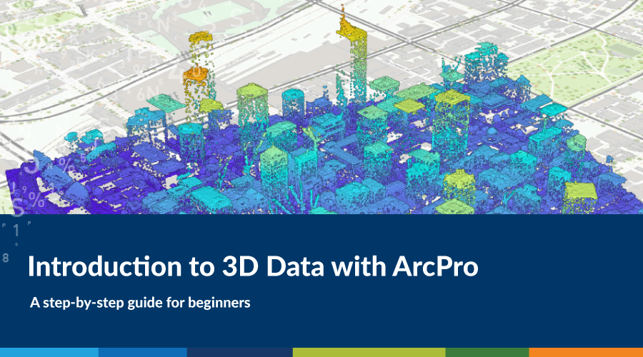 https://spatialvision.com.au/wp-content/uploads/2020/04/Blog-cover.png
500
900
Spatial Vision
https://spatialvision.com.au/wp-content/uploads/2020/04/SV_Logo_Inline.png
Spatial Vision2020-04-23 08:28:242023-12-20 12:12:22Introduction to 3D Data with ArcPro
https://spatialvision.com.au/wp-content/uploads/2020/04/Blog-cover.png
500
900
Spatial Vision
https://spatialvision.com.au/wp-content/uploads/2020/04/SV_Logo_Inline.png
Spatial Vision2020-04-23 08:28:242023-12-20 12:12:22Introduction to 3D Data with ArcPro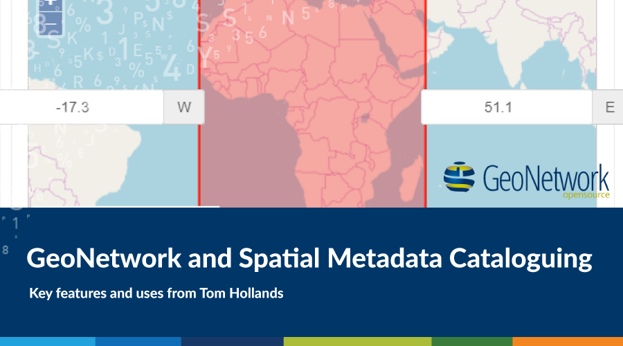 https://spatialvision.com.au/wp-content/uploads/2020/03/GeoNetworkCover.png
500
900
Tom Hollands
https://spatialvision.com.au/wp-content/uploads/2020/04/SV_Logo_Inline.png
Tom Hollands2020-03-03 09:53:352023-12-20 12:12:40GeoNetwork and Spatial Metadata Cataloguing
https://spatialvision.com.au/wp-content/uploads/2020/03/GeoNetworkCover.png
500
900
Tom Hollands
https://spatialvision.com.au/wp-content/uploads/2020/04/SV_Logo_Inline.png
Tom Hollands2020-03-03 09:53:352023-12-20 12:12:40GeoNetwork and Spatial Metadata Cataloguing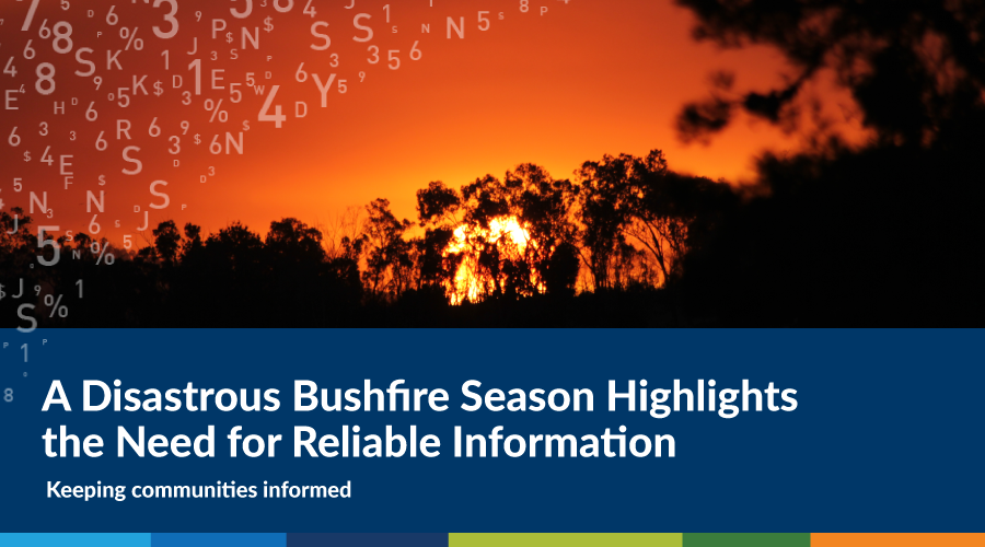 https://spatialvision.com.au/wp-content/uploads/2020/01/Blog-cover.png
500
900
Graeme Martin
https://spatialvision.com.au/wp-content/uploads/2020/04/SV_Logo_Inline.png
Graeme Martin2020-01-23 14:20:182023-12-20 12:13:04A Disastrous Bushfire Season Highlights the Need for Reliable Information
https://spatialvision.com.au/wp-content/uploads/2020/01/Blog-cover.png
500
900
Graeme Martin
https://spatialvision.com.au/wp-content/uploads/2020/04/SV_Logo_Inline.png
Graeme Martin2020-01-23 14:20:182023-12-20 12:13:04A Disastrous Bushfire Season Highlights the Need for Reliable Information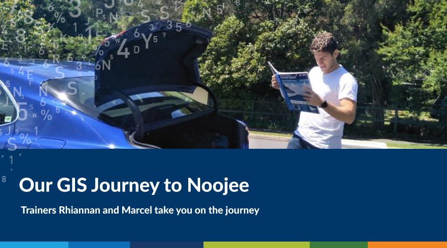 https://spatialvision.com.au/wp-content/uploads/2019/12/noojeecover.png
500
900
Marcel Sahyoune
https://spatialvision.com.au/wp-content/uploads/2020/04/SV_Logo_Inline.png
Marcel Sahyoune2019-12-13 09:03:312023-12-20 12:13:22GIS Journey to Noojee
https://spatialvision.com.au/wp-content/uploads/2019/12/noojeecover.png
500
900
Marcel Sahyoune
https://spatialvision.com.au/wp-content/uploads/2020/04/SV_Logo_Inline.png
Marcel Sahyoune2019-12-13 09:03:312023-12-20 12:13:22GIS Journey to Noojee https://spatialvision.com.au/wp-content/uploads/2019/11/Part2cover.png
500
900
Darren Edwards
https://spatialvision.com.au/wp-content/uploads/2020/04/SV_Logo_Inline.png
Darren Edwards2019-11-12 08:58:572023-12-20 12:13:39Choosing & Using a Map – Part 2
https://spatialvision.com.au/wp-content/uploads/2019/11/Part2cover.png
500
900
Darren Edwards
https://spatialvision.com.au/wp-content/uploads/2020/04/SV_Logo_Inline.png
Darren Edwards2019-11-12 08:58:572023-12-20 12:13:39Choosing & Using a Map – Part 2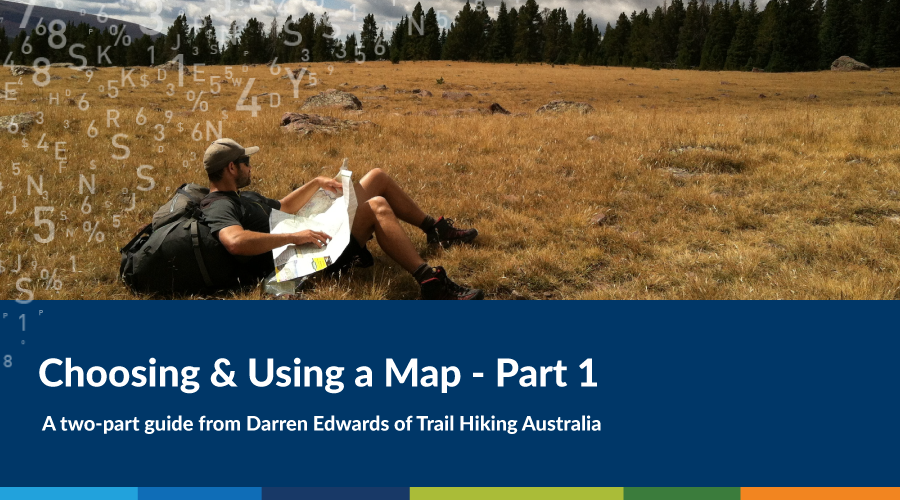 https://spatialvision.com.au/wp-content/uploads/2019/11/Part1cover.png
500
900
Darren Edwards
https://spatialvision.com.au/wp-content/uploads/2020/04/SV_Logo_Inline.png
Darren Edwards2019-11-06 08:58:462023-12-20 12:13:48Choosing & Using a Map – Part 1
https://spatialvision.com.au/wp-content/uploads/2019/11/Part1cover.png
500
900
Darren Edwards
https://spatialvision.com.au/wp-content/uploads/2020/04/SV_Logo_Inline.png
Darren Edwards2019-11-06 08:58:462023-12-20 12:13:48Choosing & Using a Map – Part 1 https://spatialvision.com.au/wp-content/uploads/2019/10/ISDE-Featured-Image.jpg
506
900
Spatial Vision
https://spatialvision.com.au/wp-content/uploads/2020/04/SV_Logo_Inline.png
Spatial Vision2019-10-29 08:26:352023-12-20 12:14:05Digital Earth in a Transformed Society
https://spatialvision.com.au/wp-content/uploads/2019/10/ISDE-Featured-Image.jpg
506
900
Spatial Vision
https://spatialvision.com.au/wp-content/uploads/2020/04/SV_Logo_Inline.png
Spatial Vision2019-10-29 08:26:352023-12-20 12:14:05Digital Earth in a Transformed Society https://spatialvision.com.au/wp-content/uploads/2019/10/ArcGIS-Pro-Cover-Image.jpg
506
900
Rhiannan Mundana
https://spatialvision.com.au/wp-content/uploads/2020/04/SV_Logo_Inline.png
Rhiannan Mundana2019-10-18 16:57:472023-12-20 12:14:14Becoming a Pro at ArcGIS Pro
https://spatialvision.com.au/wp-content/uploads/2019/10/ArcGIS-Pro-Cover-Image.jpg
506
900
Rhiannan Mundana
https://spatialvision.com.au/wp-content/uploads/2020/04/SV_Logo_Inline.png
Rhiannan Mundana2019-10-18 16:57:472023-12-20 12:14:14Becoming a Pro at ArcGIS Pro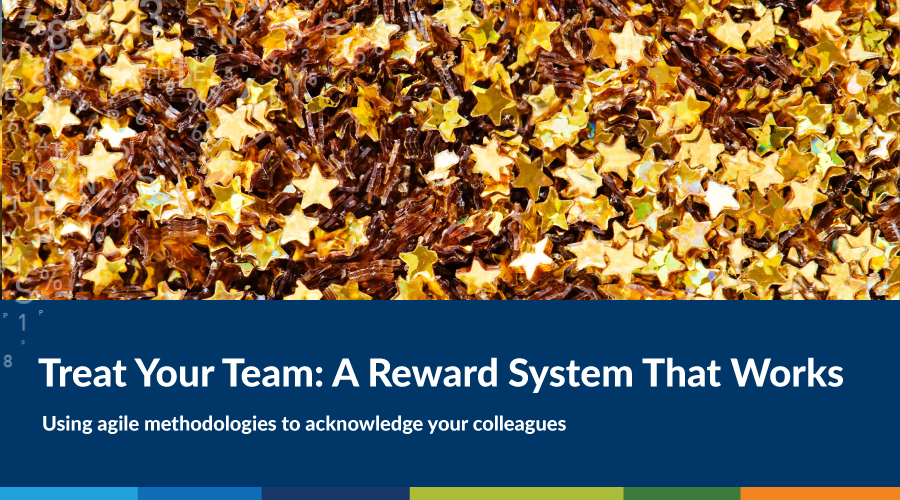 https://spatialvision.com.au/wp-content/uploads/2019/09/Blog-cover.png
500
900
Imran Qazi
https://spatialvision.com.au/wp-content/uploads/2020/04/SV_Logo_Inline.png
Imran Qazi2019-09-19 08:41:012023-12-20 12:14:49Treat Your Team: A Reward System That Works
https://spatialvision.com.au/wp-content/uploads/2019/09/Blog-cover.png
500
900
Imran Qazi
https://spatialvision.com.au/wp-content/uploads/2020/04/SV_Logo_Inline.png
Imran Qazi2019-09-19 08:41:012023-12-20 12:14:49Treat Your Team: A Reward System That Works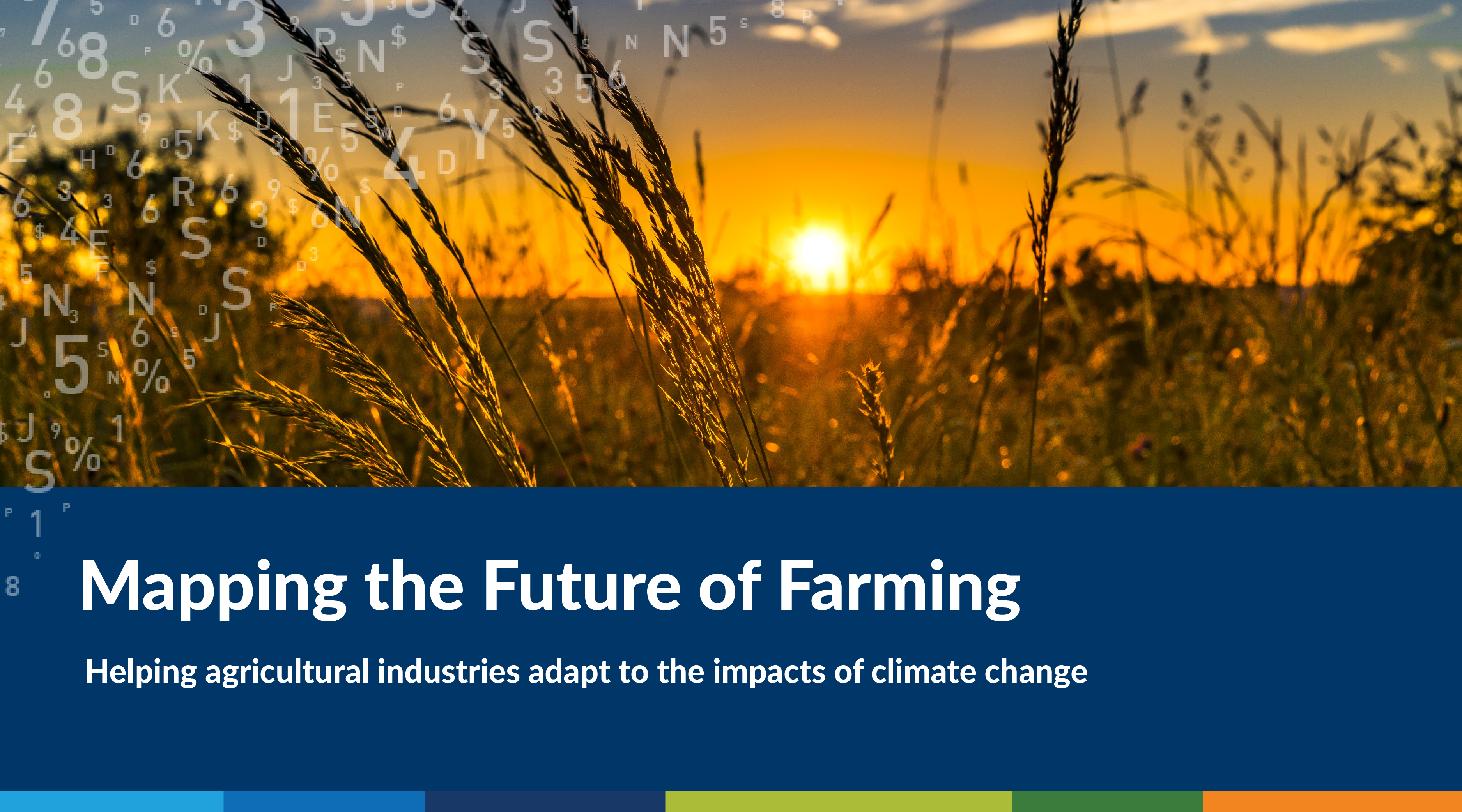 https://spatialvision.com.au/wp-content/uploads/2019/08/Blog-cover-01.png
2084
3750
Harmen Romeijn
https://spatialvision.com.au/wp-content/uploads/2020/04/SV_Logo_Inline.png
Harmen Romeijn2019-08-09 15:26:502023-12-20 12:15:22Mapping the Future of Farming
https://spatialvision.com.au/wp-content/uploads/2019/08/Blog-cover-01.png
2084
3750
Harmen Romeijn
https://spatialvision.com.au/wp-content/uploads/2020/04/SV_Logo_Inline.png
Harmen Romeijn2019-08-09 15:26:502023-12-20 12:15:22Mapping the Future of Farming https://spatialvision.com.au/wp-content/uploads/2019/07/Blog-cover-part-2.jpg
500
900
Tom Hollands
https://spatialvision.com.au/wp-content/uploads/2020/04/SV_Logo_Inline.png
Tom Hollands2019-07-12 16:04:482023-12-20 12:15:49Getting Started with Power BI Part 2
https://spatialvision.com.au/wp-content/uploads/2019/07/Blog-cover-part-2.jpg
500
900
Tom Hollands
https://spatialvision.com.au/wp-content/uploads/2020/04/SV_Logo_Inline.png
Tom Hollands2019-07-12 16:04:482023-12-20 12:15:49Getting Started with Power BI Part 2 https://spatialvision.com.au/wp-content/uploads/2019/07/Blog-cover-01-2.jpg
500
900
Tom Hollands
https://spatialvision.com.au/wp-content/uploads/2020/04/SV_Logo_Inline.png
Tom Hollands2019-07-04 16:04:302023-12-20 12:16:13Getting Started with Power BI Part 1
https://spatialvision.com.au/wp-content/uploads/2019/07/Blog-cover-01-2.jpg
500
900
Tom Hollands
https://spatialvision.com.au/wp-content/uploads/2020/04/SV_Logo_Inline.png
Tom Hollands2019-07-04 16:04:302023-12-20 12:16:13Getting Started with Power BI Part 1 https://spatialvision.com.au/wp-content/uploads/2019/01/OSS-pt3.png
500
900
Tom Hollands
https://spatialvision.com.au/wp-content/uploads/2020/04/SV_Logo_Inline.png
Tom Hollands2019-05-14 09:57:262023-12-20 12:16:30Open Source Spatial: Setting up an Anaconda Python Environment
https://spatialvision.com.au/wp-content/uploads/2019/01/OSS-pt3.png
500
900
Tom Hollands
https://spatialvision.com.au/wp-content/uploads/2020/04/SV_Logo_Inline.png
Tom Hollands2019-05-14 09:57:262023-12-20 12:16:30Open Source Spatial: Setting up an Anaconda Python Environment https://spatialvision.com.au/wp-content/uploads/2019/01/OSS-pt2.png
500
900
Tom Hollands
https://spatialvision.com.au/wp-content/uploads/2020/04/SV_Logo_Inline.png
Tom Hollands2019-04-02 11:57:072023-12-20 12:17:20Open Source Spatial – GeoPandas, Part 2
https://spatialvision.com.au/wp-content/uploads/2019/01/OSS-pt2.png
500
900
Tom Hollands
https://spatialvision.com.au/wp-content/uploads/2020/04/SV_Logo_Inline.png
Tom Hollands2019-04-02 11:57:072023-12-20 12:17:20Open Source Spatial – GeoPandas, Part 2 https://spatialvision.com.au/wp-content/uploads/2019/01/OSS-pt1.png
500
900
Tom Hollands
https://spatialvision.com.au/wp-content/uploads/2020/04/SV_Logo_Inline.png
Tom Hollands2019-03-20 15:58:092023-12-20 12:17:41Open Source Spatial: GeoPandas Part 1
https://spatialvision.com.au/wp-content/uploads/2019/01/OSS-pt1.png
500
900
Tom Hollands
https://spatialvision.com.au/wp-content/uploads/2020/04/SV_Logo_Inline.png
Tom Hollands2019-03-20 15:58:092023-12-20 12:17:41Open Source Spatial: GeoPandas Part 1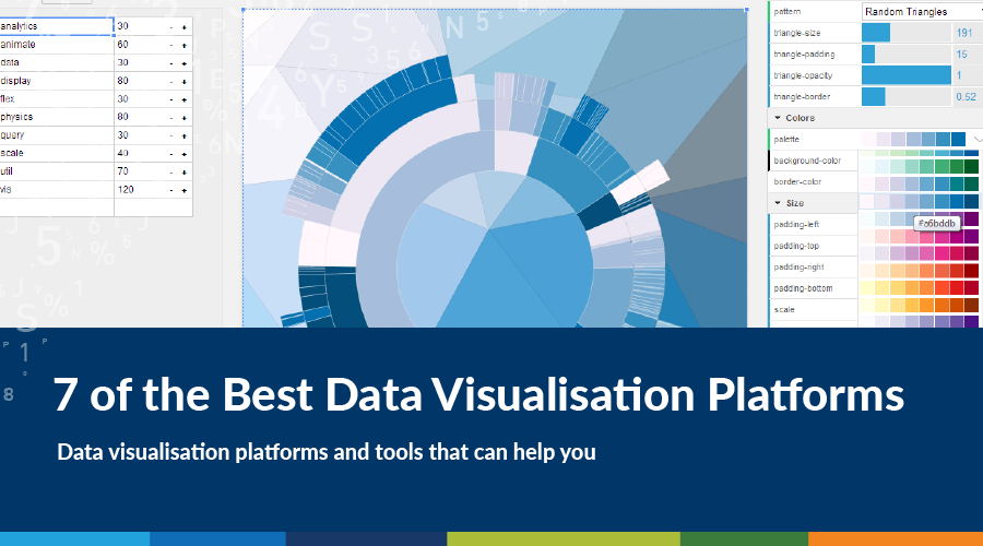 https://spatialvision.com.au/wp-content/uploads/2019/01/7-of-the-Best-Data-Visualisation-Platforms.png
500
900
Spatial Vision
https://spatialvision.com.au/wp-content/uploads/2020/04/SV_Logo_Inline.png
Spatial Vision2019-03-08 10:58:052023-12-20 12:17:497 of the Best Data Visualisation Platforms
https://spatialvision.com.au/wp-content/uploads/2019/01/7-of-the-Best-Data-Visualisation-Platforms.png
500
900
Spatial Vision
https://spatialvision.com.au/wp-content/uploads/2020/04/SV_Logo_Inline.png
Spatial Vision2019-03-08 10:58:052023-12-20 12:17:497 of the Best Data Visualisation Platforms https://spatialvision.com.au/wp-content/uploads/2019/03/ORG-header.png
500
900
Marcel Sahyoune
https://spatialvision.com.au/wp-content/uploads/2020/04/SV_Logo_Inline.png
Marcel Sahyoune2019-03-05 12:14:202023-12-20 12:17:56Creating Maps for Adventurers
https://spatialvision.com.au/wp-content/uploads/2019/03/ORG-header.png
500
900
Marcel Sahyoune
https://spatialvision.com.au/wp-content/uploads/2020/04/SV_Logo_Inline.png
Marcel Sahyoune2019-03-05 12:14:202023-12-20 12:17:56Creating Maps for Adventurers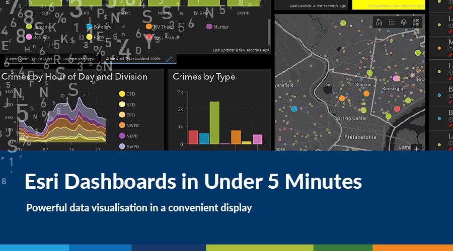 https://spatialvision.com.au/wp-content/uploads/2019/03/Dashboard-cover.png
500
900
Amelia Lazarus
https://spatialvision.com.au/wp-content/uploads/2020/04/SV_Logo_Inline.png
Amelia Lazarus2019-02-22 12:04:062023-12-20 12:18:02Esri Dashboards in Under 5 Minutes
https://spatialvision.com.au/wp-content/uploads/2019/03/Dashboard-cover.png
500
900
Amelia Lazarus
https://spatialvision.com.au/wp-content/uploads/2020/04/SV_Logo_Inline.png
Amelia Lazarus2019-02-22 12:04:062023-12-20 12:18:02Esri Dashboards in Under 5 Minutes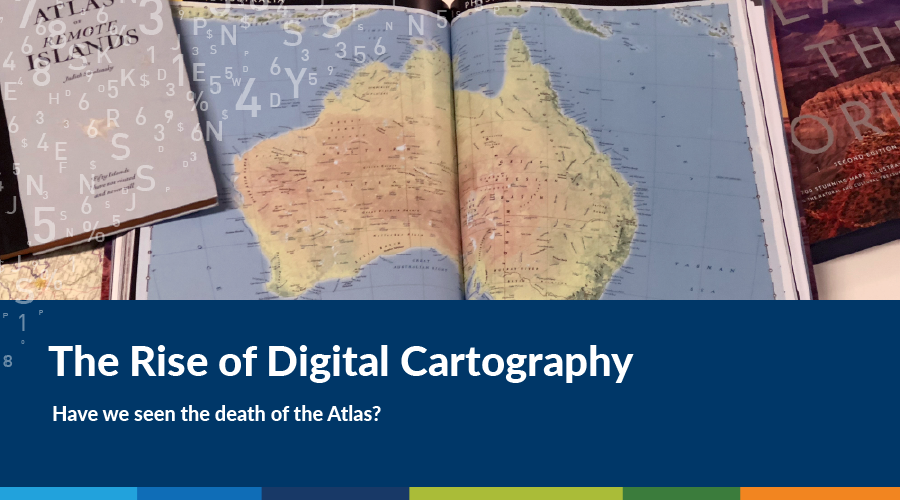 https://spatialvision.com.au/wp-content/uploads/2019/02/Atlas-Cover2.png
500
900
Spatial Vision
https://spatialvision.com.au/wp-content/uploads/2020/04/SV_Logo_Inline.png
Spatial Vision2019-02-18 00:14:292023-12-20 12:18:09Have We Seen The Death Of The Atlas?
https://spatialvision.com.au/wp-content/uploads/2019/02/Atlas-Cover2.png
500
900
Spatial Vision
https://spatialvision.com.au/wp-content/uploads/2020/04/SV_Logo_Inline.png
Spatial Vision2019-02-18 00:14:292023-12-20 12:18:09Have We Seen The Death Of The Atlas?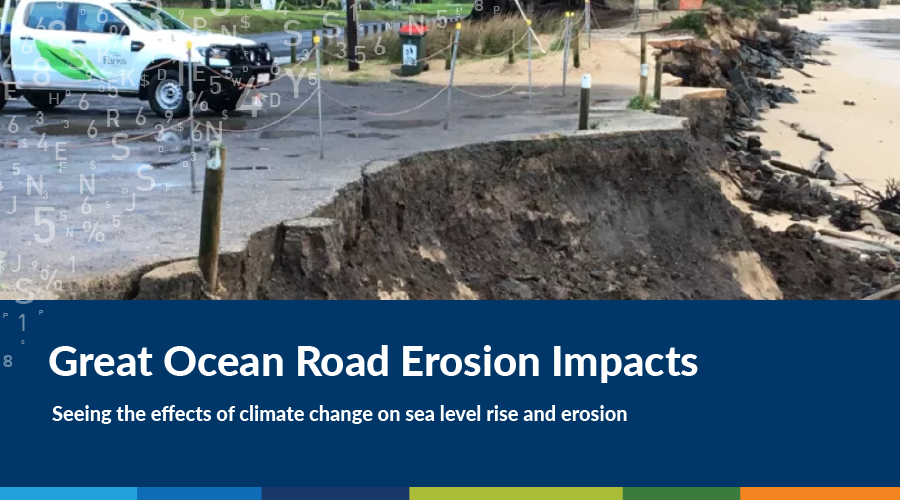 https://spatialvision.com.au/wp-content/uploads/2019/01/GOR-erosion.png
500
900
Harmen Romeijn
https://spatialvision.com.au/wp-content/uploads/2020/04/SV_Logo_Inline.png
Harmen Romeijn2019-01-10 23:00:372023-12-20 12:18:23Great Ocean Road Erosion Impacts
https://spatialvision.com.au/wp-content/uploads/2019/01/GOR-erosion.png
500
900
Harmen Romeijn
https://spatialvision.com.au/wp-content/uploads/2020/04/SV_Logo_Inline.png
Harmen Romeijn2019-01-10 23:00:372023-12-20 12:18:23Great Ocean Road Erosion Impacts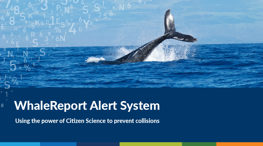 https://spatialvision.com.au/wp-content/uploads/2019/01/WRAS.png
500
900
John Heskins
https://spatialvision.com.au/wp-content/uploads/2020/04/SV_Logo_Inline.png
John Heskins2018-12-18 22:58:512023-12-20 12:18:38Mobile alert system prevents collisions at sea
https://spatialvision.com.au/wp-content/uploads/2019/01/WRAS.png
500
900
John Heskins
https://spatialvision.com.au/wp-content/uploads/2020/04/SV_Logo_Inline.png
John Heskins2018-12-18 22:58:512023-12-20 12:18:38Mobile alert system prevents collisions at sea https://spatialvision.com.au/wp-content/uploads/2019/01/UN-congress.png
500
900
Glenn Cockerton
https://spatialvision.com.au/wp-content/uploads/2020/04/SV_Logo_Inline.png
Glenn Cockerton2018-12-11 22:56:332023-12-20 12:18:54The UN World Geospatial Information Congress
https://spatialvision.com.au/wp-content/uploads/2019/01/UN-congress.png
500
900
Glenn Cockerton
https://spatialvision.com.au/wp-content/uploads/2020/04/SV_Logo_Inline.png
Glenn Cockerton2018-12-11 22:56:332023-12-20 12:18:54The UN World Geospatial Information Congress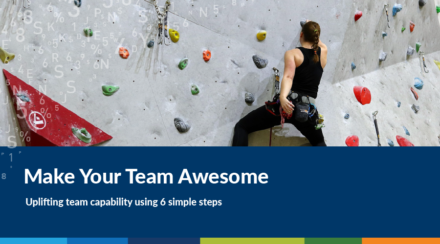 https://spatialvision.com.au/wp-content/uploads/2019/01/Agile.png
500
900
Imran Qazi
https://spatialvision.com.au/wp-content/uploads/2020/04/SV_Logo_Inline.png
Imran Qazi2018-10-10 22:54:532023-12-20 12:19:33Make Your Team Awesome
https://spatialvision.com.au/wp-content/uploads/2019/01/Agile.png
500
900
Imran Qazi
https://spatialvision.com.au/wp-content/uploads/2020/04/SV_Logo_Inline.png
Imran Qazi2018-10-10 22:54:532023-12-20 12:19:33Make Your Team Awesome https://spatialvision.com.au/wp-content/uploads/2019/01/Accreditation-in-the-Spatial-Industry.png
500
900
Geoff Williams
https://spatialvision.com.au/wp-content/uploads/2020/04/SV_Logo_Inline.png
Geoff Williams2018-10-05 10:52:102023-12-20 12:19:52The Importance of Accreditation in the Spatial Industry
https://spatialvision.com.au/wp-content/uploads/2019/01/Accreditation-in-the-Spatial-Industry.png
500
900
Geoff Williams
https://spatialvision.com.au/wp-content/uploads/2020/04/SV_Logo_Inline.png
Geoff Williams2018-10-05 10:52:102023-12-20 12:19:52The Importance of Accreditation in the Spatial Industry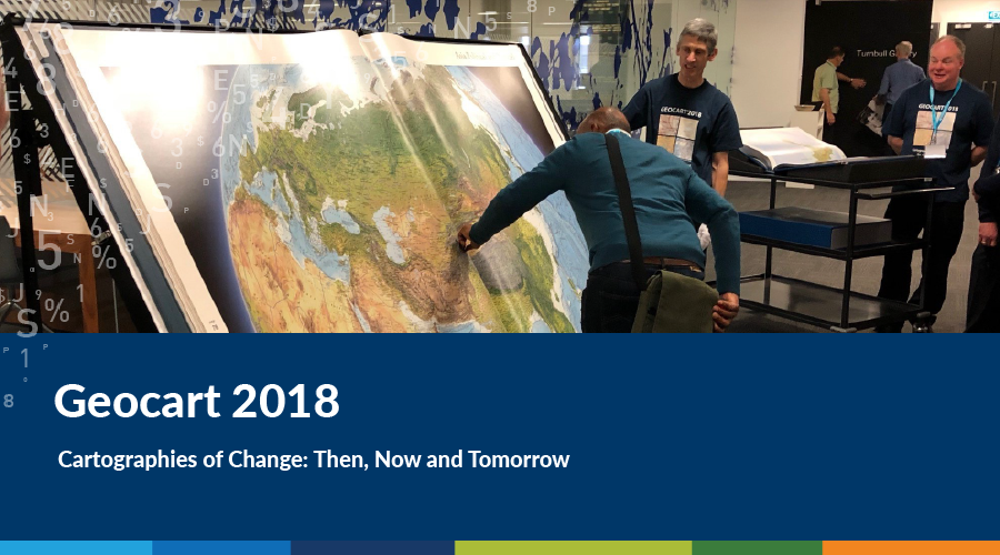 https://spatialvision.com.au/wp-content/uploads/2019/01/Geocart-2018.png
500
900
Spatial Vision
https://spatialvision.com.au/wp-content/uploads/2020/04/SV_Logo_Inline.png
Spatial Vision2018-09-03 10:50:182023-12-20 12:20:17Geocart 2018
https://spatialvision.com.au/wp-content/uploads/2019/01/Geocart-2018.png
500
900
Spatial Vision
https://spatialvision.com.au/wp-content/uploads/2020/04/SV_Logo_Inline.png
Spatial Vision2018-09-03 10:50:182023-12-20 12:20:17Geocart 2018 https://spatialvision.com.au/wp-content/uploads/2019/01/Monitoring-the-Metropolitan-Development-Boom.png
500
900
Jeremy Alcorn
https://spatialvision.com.au/wp-content/uploads/2020/04/SV_Logo_Inline.png
Jeremy Alcorn2018-08-09 10:48:202023-12-20 12:20:39Monitoring the Metropolitan Development Boom
https://spatialvision.com.au/wp-content/uploads/2019/01/Monitoring-the-Metropolitan-Development-Boom.png
500
900
Jeremy Alcorn
https://spatialvision.com.au/wp-content/uploads/2020/04/SV_Logo_Inline.png
Jeremy Alcorn2018-08-09 10:48:202023-12-20 12:20:39Monitoring the Metropolitan Development Boom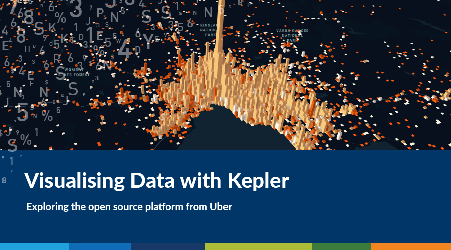 https://spatialvision.com.au/wp-content/uploads/2019/01/Visualising-Data-with-Kepler.png
500
900
Amelia Lazarus
https://spatialvision.com.au/wp-content/uploads/2020/04/SV_Logo_Inline.png
Amelia Lazarus2018-07-30 22:44:402023-12-20 12:22:58Visualising Data with Kepler
https://spatialvision.com.au/wp-content/uploads/2019/01/Visualising-Data-with-Kepler.png
500
900
Amelia Lazarus
https://spatialvision.com.au/wp-content/uploads/2020/04/SV_Logo_Inline.png
Amelia Lazarus2018-07-30 22:44:402023-12-20 12:22:58Visualising Data with Kepler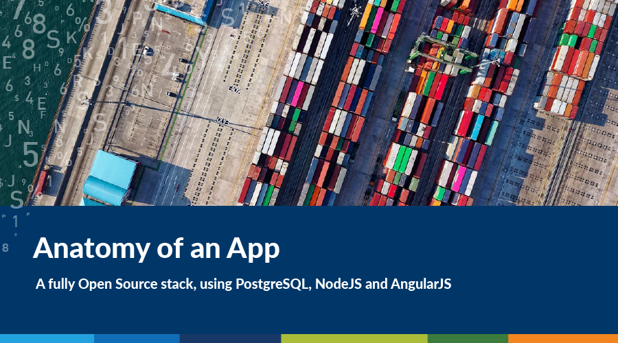 https://spatialvision.com.au/wp-content/uploads/2019/01/App-anatomy.png
500
900
Tom Hollands
https://spatialvision.com.au/wp-content/uploads/2020/04/SV_Logo_Inline.png
Tom Hollands2018-07-27 22:42:082023-12-20 12:23:06Anatomy of an App: A Fully Open Source Stack
https://spatialvision.com.au/wp-content/uploads/2019/01/App-anatomy.png
500
900
Tom Hollands
https://spatialvision.com.au/wp-content/uploads/2020/04/SV_Logo_Inline.png
Tom Hollands2018-07-27 22:42:082023-12-20 12:23:06Anatomy of an App: A Fully Open Source Stack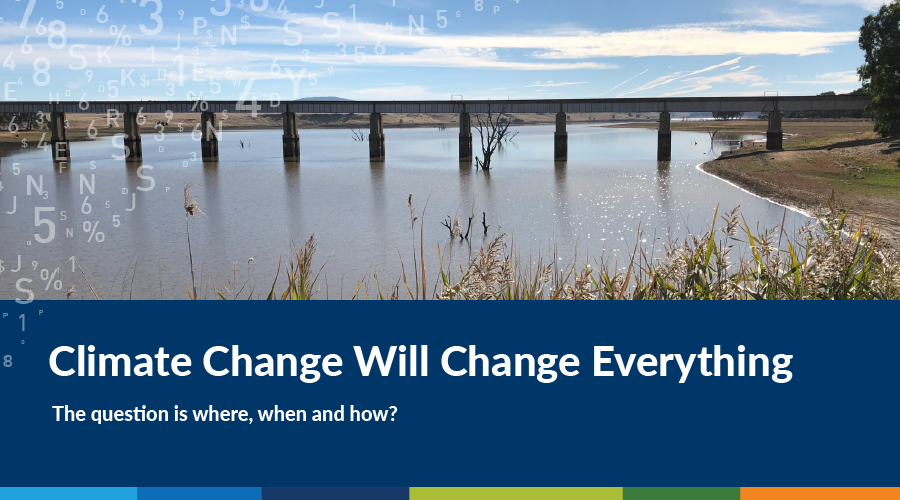 https://spatialvision.com.au/wp-content/uploads/2019/01/Climate-Change-Will-Change-Everything.png
500
900
Stephen Farrell
https://spatialvision.com.au/wp-content/uploads/2020/04/SV_Logo_Inline.png
Stephen Farrell2018-07-05 10:39:502021-03-16 21:50:59Climate Change Will Change Everything
https://spatialvision.com.au/wp-content/uploads/2019/01/Climate-Change-Will-Change-Everything.png
500
900
Stephen Farrell
https://spatialvision.com.au/wp-content/uploads/2020/04/SV_Logo_Inline.png
Stephen Farrell2018-07-05 10:39:502021-03-16 21:50:59Climate Change Will Change Everything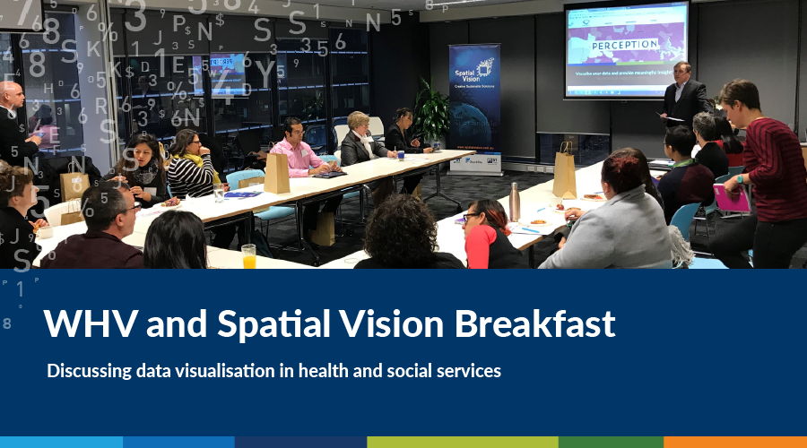 https://spatialvision.com.au/wp-content/uploads/2019/01/WHV-and-Spatial-Vision-Breakfast.png
500
900
Spatial Vision
https://spatialvision.com.au/wp-content/uploads/2020/04/SV_Logo_Inline.png
Spatial Vision2018-06-27 22:36:532023-12-20 12:23:34Data Visualisation in Health and Social Services
https://spatialvision.com.au/wp-content/uploads/2019/01/WHV-and-Spatial-Vision-Breakfast.png
500
900
Spatial Vision
https://spatialvision.com.au/wp-content/uploads/2020/04/SV_Logo_Inline.png
Spatial Vision2018-06-27 22:36:532023-12-20 12:23:34Data Visualisation in Health and Social Services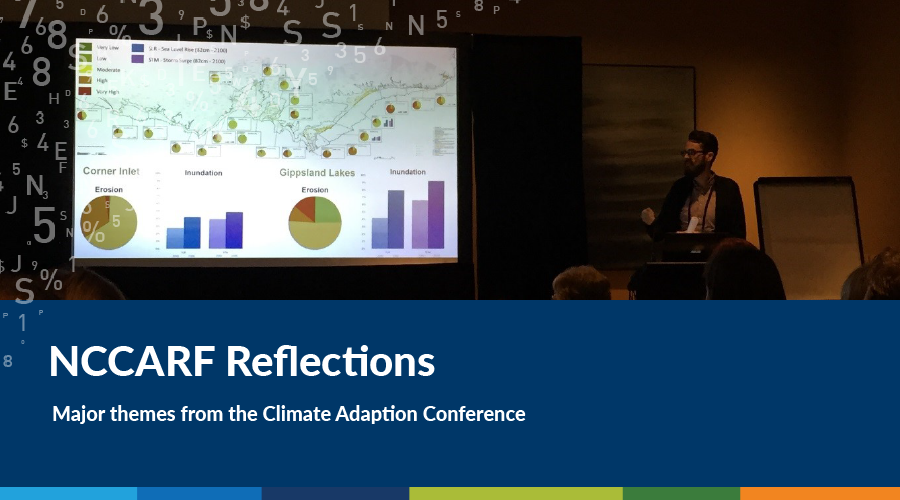 https://spatialvision.com.au/wp-content/uploads/2019/01/NCCARF.png
500
900
Harmen Romeijn
https://spatialvision.com.au/wp-content/uploads/2020/04/SV_Logo_Inline.png
Harmen Romeijn2018-06-19 22:33:022023-12-20 12:23:41Climate Change Adaption Research
https://spatialvision.com.au/wp-content/uploads/2019/01/NCCARF.png
500
900
Harmen Romeijn
https://spatialvision.com.au/wp-content/uploads/2020/04/SV_Logo_Inline.png
Harmen Romeijn2018-06-19 22:33:022023-12-20 12:23:41Climate Change Adaption Research https://spatialvision.com.au/wp-content/uploads/2019/01/Dealing-With-Metadata.png
500
900
Tom Hollands
https://spatialvision.com.au/wp-content/uploads/2020/04/SV_Logo_Inline.png
Tom Hollands2018-05-25 22:30:032023-12-20 12:23:48How Do You Solve A Problem Like Metadata?
https://spatialvision.com.au/wp-content/uploads/2019/01/Dealing-With-Metadata.png
500
900
Tom Hollands
https://spatialvision.com.au/wp-content/uploads/2020/04/SV_Logo_Inline.png
Tom Hollands2018-05-25 22:30:032023-12-20 12:23:48How Do You Solve A Problem Like Metadata? https://spatialvision.com.au/wp-content/uploads/2019/01/Why-Do-Local-Governments-Need-GIS-Strategies.png
500
900
Graeme Martin
https://spatialvision.com.au/wp-content/uploads/2020/04/SV_Logo_Inline.png
Graeme Martin2018-05-22 22:27:152023-12-20 12:23:56Why Do Local Governments Need GIS Strategies?
https://spatialvision.com.au/wp-content/uploads/2019/01/Why-Do-Local-Governments-Need-GIS-Strategies.png
500
900
Graeme Martin
https://spatialvision.com.au/wp-content/uploads/2020/04/SV_Logo_Inline.png
Graeme Martin2018-05-22 22:27:152023-12-20 12:23:56Why Do Local Governments Need GIS Strategies?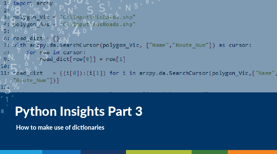 https://spatialvision.com.au/wp-content/uploads/2018/05/python3.png
500
900
Harmen Romeijn
https://spatialvision.com.au/wp-content/uploads/2020/04/SV_Logo_Inline.png
Harmen Romeijn2018-05-18 22:24:152023-12-20 12:24:07Python Insights: How to make use of Dictionaries
https://spatialvision.com.au/wp-content/uploads/2018/05/python3.png
500
900
Harmen Romeijn
https://spatialvision.com.au/wp-content/uploads/2020/04/SV_Logo_Inline.png
Harmen Romeijn2018-05-18 22:24:152023-12-20 12:24:07Python Insights: How to make use of Dictionaries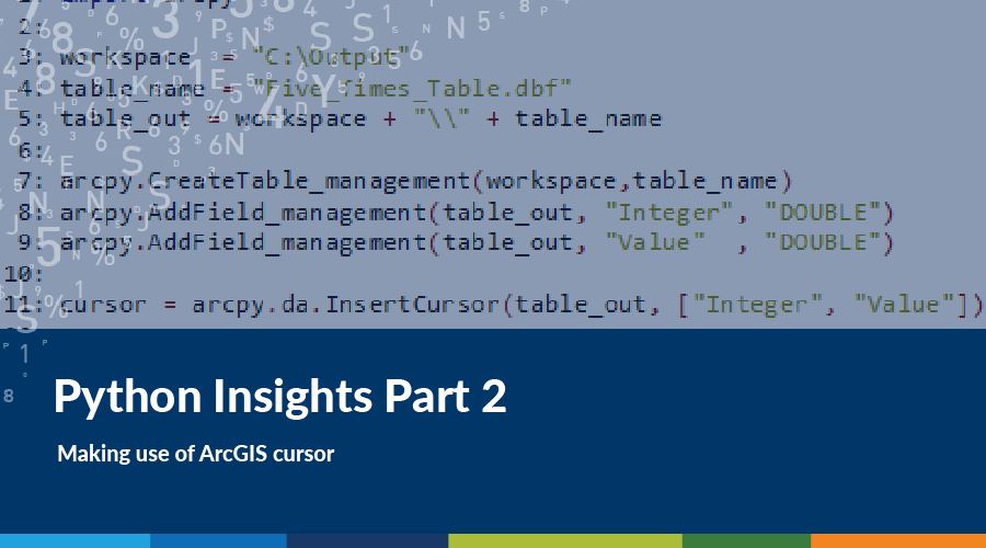 https://spatialvision.com.au/wp-content/uploads/2019/01/Python-Insight2.png
500
900
Harmen Romeijn
https://spatialvision.com.au/wp-content/uploads/2020/04/SV_Logo_Inline.png
Harmen Romeijn2018-05-10 22:22:332023-12-20 12:24:15Python Insights: Making use of ArcGIS Cursor
https://spatialvision.com.au/wp-content/uploads/2019/01/Python-Insight2.png
500
900
Harmen Romeijn
https://spatialvision.com.au/wp-content/uploads/2020/04/SV_Logo_Inline.png
Harmen Romeijn2018-05-10 22:22:332023-12-20 12:24:15Python Insights: Making use of ArcGIS Cursor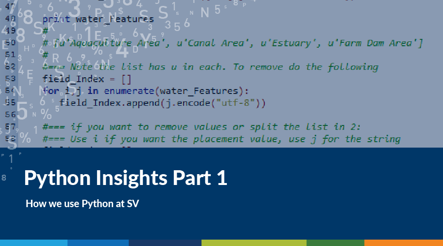 https://spatialvision.com.au/wp-content/uploads/2019/01/Python-Insights1.png
500
900
Mandy Tyrer
https://spatialvision.com.au/wp-content/uploads/2020/04/SV_Logo_Inline.png
Mandy Tyrer2018-04-04 22:20:272023-12-20 12:24:59Python Insights: How we use Python at Spatial Vision
https://spatialvision.com.au/wp-content/uploads/2019/01/Python-Insights1.png
500
900
Mandy Tyrer
https://spatialvision.com.au/wp-content/uploads/2020/04/SV_Logo_Inline.png
Mandy Tyrer2018-04-04 22:20:272023-12-20 12:24:59Python Insights: How we use Python at Spatial Vision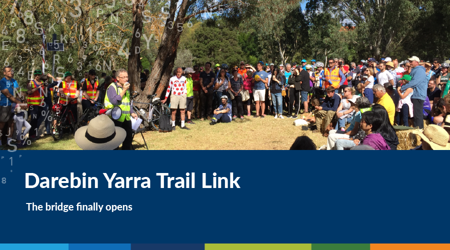 https://spatialvision.com.au/wp-content/uploads/2019/01/Darebin-Yarra-Trail-Link.png
500
900
Stephen Farrell
https://spatialvision.com.au/wp-content/uploads/2020/04/SV_Logo_Inline.png
Stephen Farrell2018-03-22 22:17:412023-12-20 12:25:07Darebin Yarra Trail Link
https://spatialvision.com.au/wp-content/uploads/2019/01/Darebin-Yarra-Trail-Link.png
500
900
Stephen Farrell
https://spatialvision.com.au/wp-content/uploads/2020/04/SV_Logo_Inline.png
Stephen Farrell2018-03-22 22:17:412023-12-20 12:25:07Darebin Yarra Trail Link https://spatialvision.com.au/wp-content/uploads/2019/01/Above-the-Politics.png
500
900
Stephen Farrell
https://spatialvision.com.au/wp-content/uploads/2020/04/SV_Logo_Inline.png
Stephen Farrell2018-03-12 22:15:362023-12-20 12:25:15Climate Change – Above the Politics
https://spatialvision.com.au/wp-content/uploads/2019/01/Above-the-Politics.png
500
900
Stephen Farrell
https://spatialvision.com.au/wp-content/uploads/2020/04/SV_Logo_Inline.png
Stephen Farrell2018-03-12 22:15:362023-12-20 12:25:15Climate Change – Above the Politics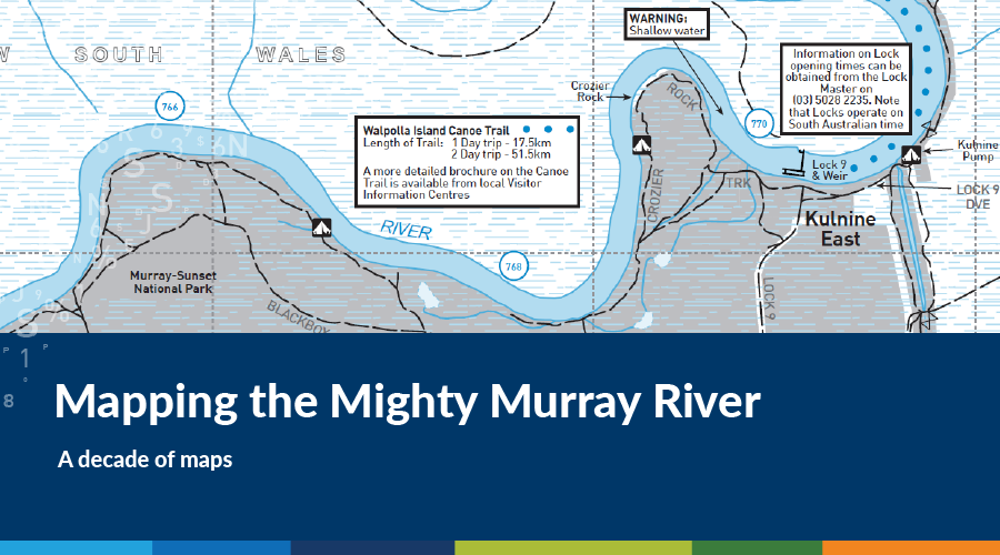 https://spatialvision.com.au/wp-content/uploads/2019/01/Mapping-the-Mighty-Murray-River.png
500
900
Spatial Vision
https://spatialvision.com.au/wp-content/uploads/2020/04/SV_Logo_Inline.png
Spatial Vision2018-03-02 22:11:372019-10-02 09:42:21Mapping the Mighty Murray River
https://spatialvision.com.au/wp-content/uploads/2019/01/Mapping-the-Mighty-Murray-River.png
500
900
Spatial Vision
https://spatialvision.com.au/wp-content/uploads/2020/04/SV_Logo_Inline.png
Spatial Vision2018-03-02 22:11:372019-10-02 09:42:21Mapping the Mighty Murray River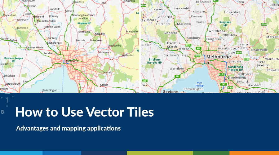 https://spatialvision.com.au/wp-content/uploads/2019/01/How-to-Use-Vector-Tiles.png
500
900
Harmen Romeijn
https://spatialvision.com.au/wp-content/uploads/2020/04/SV_Logo_Inline.png
Harmen Romeijn2018-02-12 22:04:282023-12-20 12:33:22How to Use Vector Tiles
https://spatialvision.com.au/wp-content/uploads/2019/01/How-to-Use-Vector-Tiles.png
500
900
Harmen Romeijn
https://spatialvision.com.au/wp-content/uploads/2020/04/SV_Logo_Inline.png
Harmen Romeijn2018-02-12 22:04:282023-12-20 12:33:22How to Use Vector Tiles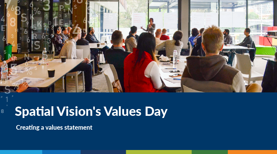 https://spatialvision.com.au/wp-content/uploads/2019/01/Spatial-Visions-Values-Day.png
500
900
Spatial Vision
https://spatialvision.com.au/wp-content/uploads/2020/04/SV_Logo_Inline.png
Spatial Vision2018-02-02 05:49:052023-12-20 12:33:28Spatial Vision’s Values Day
https://spatialvision.com.au/wp-content/uploads/2019/01/Spatial-Visions-Values-Day.png
500
900
Spatial Vision
https://spatialvision.com.au/wp-content/uploads/2020/04/SV_Logo_Inline.png
Spatial Vision2018-02-02 05:49:052023-12-20 12:33:28Spatial Vision’s Values Day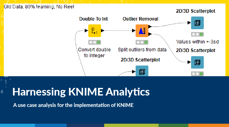 https://spatialvision.com.au/wp-content/uploads/2019/01/Harnessing-KNIME-Analytics.png
500
900
Spatial Vision
https://spatialvision.com.au/wp-content/uploads/2020/04/SV_Logo_Inline.png
Spatial Vision2018-01-18 05:54:302023-12-20 12:33:34Harnessing KNIME Analytics
https://spatialvision.com.au/wp-content/uploads/2019/01/Harnessing-KNIME-Analytics.png
500
900
Spatial Vision
https://spatialvision.com.au/wp-content/uploads/2020/04/SV_Logo_Inline.png
Spatial Vision2018-01-18 05:54:302023-12-20 12:33:34Harnessing KNIME Analytics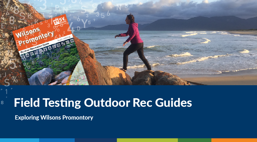 https://spatialvision.com.au/wp-content/uploads/2019/01/Field-Testing-Outdoor-Rec-Guides.png
500
900
Darren Edwards
https://spatialvision.com.au/wp-content/uploads/2020/04/SV_Logo_Inline.png
Darren Edwards2018-01-08 05:51:562023-12-20 12:33:41Field Testing Outdoor Rec Guides
https://spatialvision.com.au/wp-content/uploads/2019/01/Field-Testing-Outdoor-Rec-Guides.png
500
900
Darren Edwards
https://spatialvision.com.au/wp-content/uploads/2020/04/SV_Logo_Inline.png
Darren Edwards2018-01-08 05:51:562023-12-20 12:33:41Field Testing Outdoor Rec Guides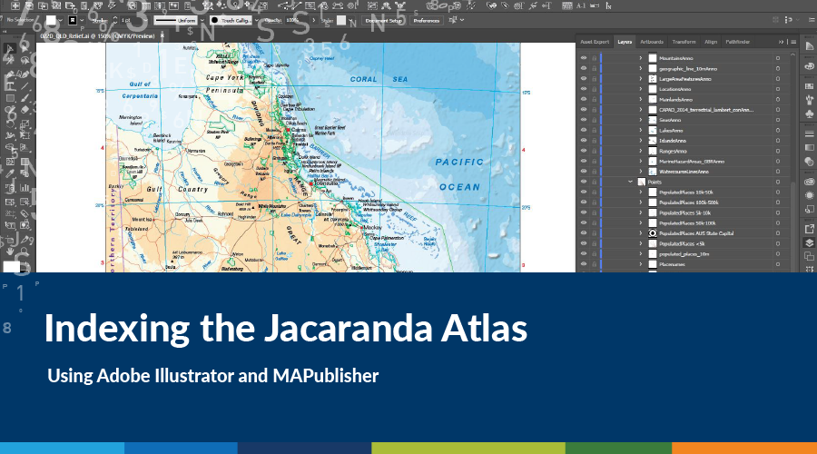 https://spatialvision.com.au/wp-content/uploads/2019/01/Indexing-the-Jacaranda-Atlas.png
500
900
Spatial Vision
https://spatialvision.com.au/wp-content/uploads/2020/04/SV_Logo_Inline.png
Spatial Vision2017-12-18 17:42:472023-12-20 12:34:03Indexing the Jacaranda Atlas
https://spatialvision.com.au/wp-content/uploads/2019/01/Indexing-the-Jacaranda-Atlas.png
500
900
Spatial Vision
https://spatialvision.com.au/wp-content/uploads/2020/04/SV_Logo_Inline.png
Spatial Vision2017-12-18 17:42:472023-12-20 12:34:03Indexing the Jacaranda Atlas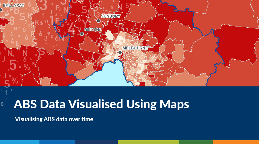 https://spatialvision.com.au/wp-content/uploads/2019/01/ABS-Data-Visualised-Using-Maps.png
500
900
Spatial Vision
https://spatialvision.com.au/wp-content/uploads/2020/04/SV_Logo_Inline.png
Spatial Vision2017-12-14 05:36:432023-12-20 12:34:10ABS Data Visualised Using Maps
https://spatialvision.com.au/wp-content/uploads/2019/01/ABS-Data-Visualised-Using-Maps.png
500
900
Spatial Vision
https://spatialvision.com.au/wp-content/uploads/2020/04/SV_Logo_Inline.png
Spatial Vision2017-12-14 05:36:432023-12-20 12:34:10ABS Data Visualised Using Maps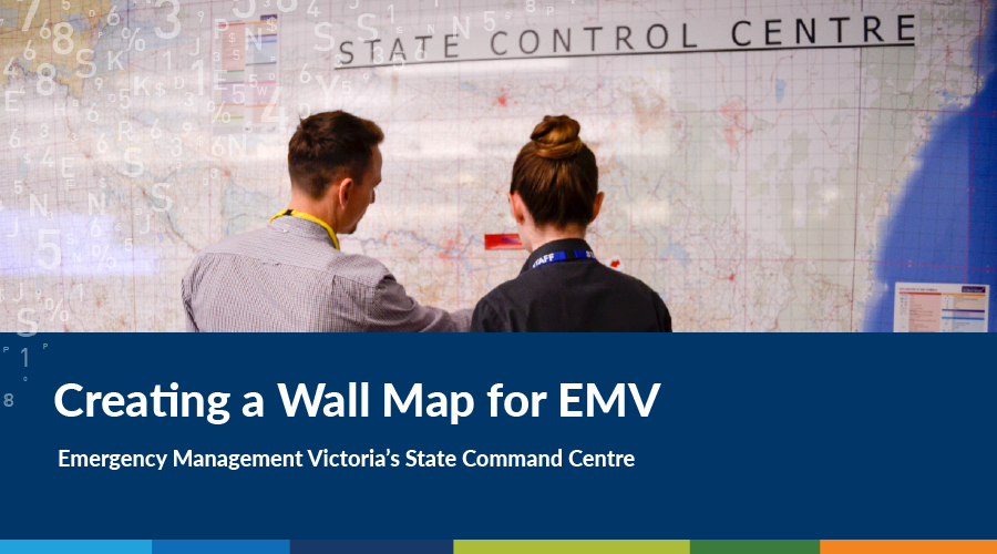 https://spatialvision.com.au/wp-content/uploads/2019/01/Creating-a-Wall-Map-for-EMV.png
500
900
Geoff Williams
https://spatialvision.com.au/wp-content/uploads/2020/04/SV_Logo_Inline.png
Geoff Williams2017-12-12 17:46:272023-12-20 12:34:18Updating the Victorian State Command Centre Wall Map
https://spatialvision.com.au/wp-content/uploads/2019/01/Creating-a-Wall-Map-for-EMV.png
500
900
Geoff Williams
https://spatialvision.com.au/wp-content/uploads/2020/04/SV_Logo_Inline.png
Geoff Williams2017-12-12 17:46:272023-12-20 12:34:18Updating the Victorian State Command Centre Wall Map https://spatialvision.com.au/wp-content/uploads/2019/01/Marriage-Equality-Visualisation.png
500
900
Spatial Vision
https://spatialvision.com.au/wp-content/uploads/2020/04/SV_Logo_Inline.png
Spatial Vision2017-11-29 05:32:052023-12-20 13:46:49Marriage Equality Visualisation
https://spatialvision.com.au/wp-content/uploads/2019/01/Marriage-Equality-Visualisation.png
500
900
Spatial Vision
https://spatialvision.com.au/wp-content/uploads/2020/04/SV_Logo_Inline.png
Spatial Vision2017-11-29 05:32:052023-12-20 13:46:49Marriage Equality Visualisation https://spatialvision.com.au/wp-content/uploads/2019/01/Making-Web-Maps-in-Chinese.png
500
900
Tom Hollands
https://spatialvision.com.au/wp-content/uploads/2020/04/SV_Logo_Inline.png
Tom Hollands2017-09-29 17:29:082023-12-20 14:40:20Making Web Maps in Chinese
https://spatialvision.com.au/wp-content/uploads/2019/01/Making-Web-Maps-in-Chinese.png
500
900
Tom Hollands
https://spatialvision.com.au/wp-content/uploads/2020/04/SV_Logo_Inline.png
Tom Hollands2017-09-29 17:29:082023-12-20 14:40:20Making Web Maps in Chinese https://spatialvision.com.au/wp-content/uploads/2019/01/Raster-and-Vector-Data-in-GIS.png
500
900
Harmen Romeijn
https://spatialvision.com.au/wp-content/uploads/2020/04/SV_Logo_Inline.png
Harmen Romeijn2017-09-11 05:22:352023-12-20 14:40:37Raster and Vector Data in GIS
https://spatialvision.com.au/wp-content/uploads/2019/01/Raster-and-Vector-Data-in-GIS.png
500
900
Harmen Romeijn
https://spatialvision.com.au/wp-content/uploads/2020/04/SV_Logo_Inline.png
Harmen Romeijn2017-09-11 05:22:352023-12-20 14:40:37Raster and Vector Data in GIS https://spatialvision.com.au/wp-content/uploads/2019/01/Health-Informatics-Conference.png
500
900
Glenn Cockerton
https://spatialvision.com.au/wp-content/uploads/2020/04/SV_Logo_Inline.png
Glenn Cockerton2017-09-07 05:24:452023-12-20 14:41:22Health Informatics Conference
https://spatialvision.com.au/wp-content/uploads/2019/01/Health-Informatics-Conference.png
500
900
Glenn Cockerton
https://spatialvision.com.au/wp-content/uploads/2020/04/SV_Logo_Inline.png
Glenn Cockerton2017-09-07 05:24:452023-12-20 14:41:22Health Informatics Conference https://spatialvision.com.au/wp-content/uploads/2019/01/CesiumJS.png
500
900
Spatial Vision
https://spatialvision.com.au/wp-content/uploads/2020/04/SV_Logo_Inline.png
Spatial Vision2017-07-14 05:18:532023-12-20 14:43:53CesiumJS
https://spatialvision.com.au/wp-content/uploads/2019/01/CesiumJS.png
500
900
Spatial Vision
https://spatialvision.com.au/wp-content/uploads/2020/04/SV_Logo_Inline.png
Spatial Vision2017-07-14 05:18:532023-12-20 14:43:53CesiumJS https://spatialvision.com.au/wp-content/uploads/2019/01/Understanding-ABS-Geographies.png
500
900
Geoff Williams
https://spatialvision.com.au/wp-content/uploads/2020/04/SV_Logo_Inline.png
Geoff Williams2017-07-13 05:15:502023-12-20 14:44:00Understanding ABS Geographies
https://spatialvision.com.au/wp-content/uploads/2019/01/Understanding-ABS-Geographies.png
500
900
Geoff Williams
https://spatialvision.com.au/wp-content/uploads/2020/04/SV_Logo_Inline.png
Geoff Williams2017-07-13 05:15:502023-12-20 14:44:00Understanding ABS Geographies https://spatialvision.com.au/wp-content/uploads/2019/01/Metes-and-Bounds.png
500
900
Jeremy Alcorn
https://spatialvision.com.au/wp-content/uploads/2020/04/SV_Logo_Inline.png
Jeremy Alcorn2017-06-29 17:13:222023-12-20 14:44:19Metes and Bounds
https://spatialvision.com.au/wp-content/uploads/2019/01/Metes-and-Bounds.png
500
900
Jeremy Alcorn
https://spatialvision.com.au/wp-content/uploads/2020/04/SV_Logo_Inline.png
Jeremy Alcorn2017-06-29 17:13:222023-12-20 14:44:19Metes and Bounds https://spatialvision.com.au/wp-content/uploads/2019/01/2026agenda.png
500
900
Glenn Cockerton
https://spatialvision.com.au/wp-content/uploads/2020/04/SV_Logo_Inline.png
Glenn Cockerton2017-05-25 17:09:282023-12-20 14:44:582026 Spatial Industry Transformation and Growth Agenda
https://spatialvision.com.au/wp-content/uploads/2019/01/2026agenda.png
500
900
Glenn Cockerton
https://spatialvision.com.au/wp-content/uploads/2020/04/SV_Logo_Inline.png
Glenn Cockerton2017-05-25 17:09:282023-12-20 14:44:582026 Spatial Industry Transformation and Growth Agenda https://spatialvision.com.au/wp-content/uploads/2019/01/scientifically-engaged-communities.png
500
900
Imran Qazi
https://spatialvision.com.au/wp-content/uploads/2020/04/SV_Logo_Inline.png
Imran Qazi2017-03-21 17:06:542023-12-20 14:45:19Inspired, Motivated and Scientifically Engaged Communities
https://spatialvision.com.au/wp-content/uploads/2019/01/scientifically-engaged-communities.png
500
900
Imran Qazi
https://spatialvision.com.au/wp-content/uploads/2020/04/SV_Logo_Inline.png
Imran Qazi2017-03-21 17:06:542023-12-20 14:45:19Inspired, Motivated and Scientifically Engaged Communities https://spatialvision.com.au/wp-content/uploads/2019/01/VicMap-Books.png
500
900
Geoff Williams
https://spatialvision.com.au/wp-content/uploads/2020/04/SV_Logo_Inline.png
Geoff Williams2016-05-29 17:00:252019-06-19 13:11:08Vicmap Books
https://spatialvision.com.au/wp-content/uploads/2019/01/VicMap-Books.png
500
900
Geoff Williams
https://spatialvision.com.au/wp-content/uploads/2020/04/SV_Logo_Inline.png
Geoff Williams2016-05-29 17:00:252019-06-19 13:11:08Vicmap Books https://spatialvision.com.au/wp-content/uploads/2019/01/location-aware.png
500
900
Imran Qazi
https://spatialvision.com.au/wp-content/uploads/2020/04/SV_Logo_Inline.png
Imran Qazi2016-03-29 16:57:092023-12-20 14:58:37Location Aware Technology
https://spatialvision.com.au/wp-content/uploads/2019/01/location-aware.png
500
900
Imran Qazi
https://spatialvision.com.au/wp-content/uploads/2020/04/SV_Logo_Inline.png
Imran Qazi2016-03-29 16:57:092023-12-20 14:58:37Location Aware Technology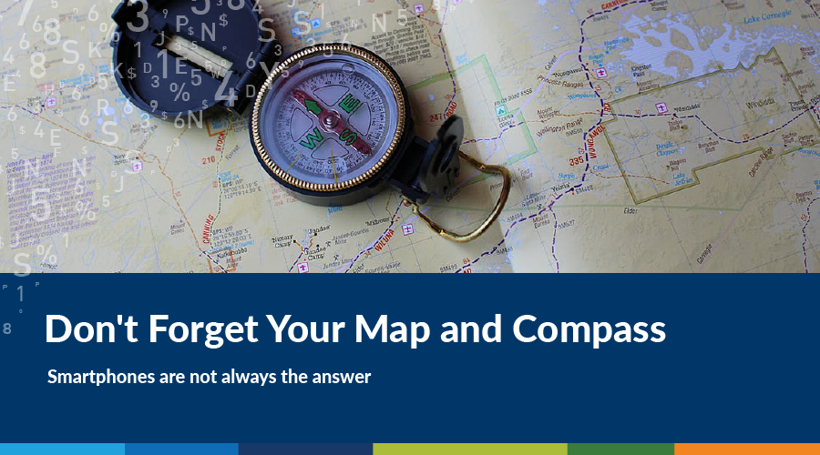 https://spatialvision.com.au/wp-content/uploads/2019/01/Dont-forget-your-map-and-compass.png
500
900
Graeme Martin
https://spatialvision.com.au/wp-content/uploads/2020/04/SV_Logo_Inline.png
Graeme Martin2015-09-11 16:50:572023-12-20 14:59:18Don’t Forget Your Map and Compass
https://spatialvision.com.au/wp-content/uploads/2019/01/Dont-forget-your-map-and-compass.png
500
900
Graeme Martin
https://spatialvision.com.au/wp-content/uploads/2020/04/SV_Logo_Inline.png
Graeme Martin2015-09-11 16:50:572023-12-20 14:59:18Don’t Forget Your Map and Compass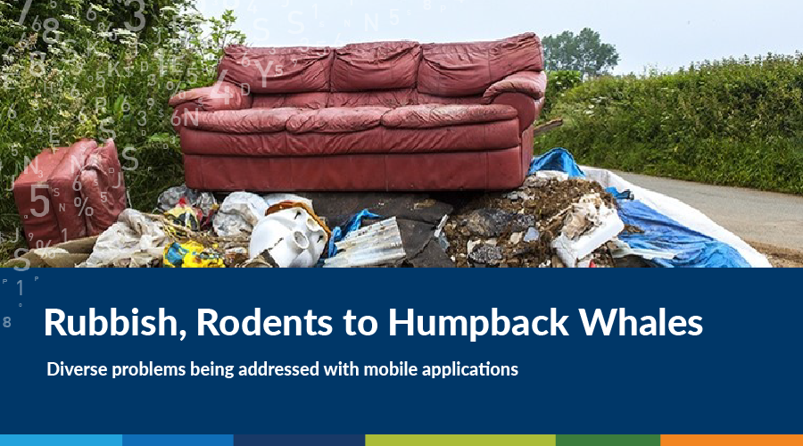 https://spatialvision.com.au/wp-content/uploads/2019/01/Rubbish-Rodents-to-Humpback-Whales.png
500
900
Spatial Vision
https://spatialvision.com.au/wp-content/uploads/2020/04/SV_Logo_Inline.png
Spatial Vision2015-03-04 16:54:362023-12-20 15:00:17Addressing critical issues with digital technology
https://spatialvision.com.au/wp-content/uploads/2019/01/Rubbish-Rodents-to-Humpback-Whales.png
500
900
Spatial Vision
https://spatialvision.com.au/wp-content/uploads/2020/04/SV_Logo_Inline.png
Spatial Vision2015-03-04 16:54:362023-12-20 15:00:17Addressing critical issues with digital technology https://spatialvision.com.au/wp-content/uploads/2019/01/What-makes-a-City-Smart-is-People.png
500
900
Graeme Martin
https://spatialvision.com.au/wp-content/uploads/2020/04/SV_Logo_Inline.png
Graeme Martin2015-01-29 16:46:502023-12-20 15:00:52What Makes a City Smart is People
https://spatialvision.com.au/wp-content/uploads/2019/01/What-makes-a-City-Smart-is-People.png
500
900
Graeme Martin
https://spatialvision.com.au/wp-content/uploads/2020/04/SV_Logo_Inline.png
Graeme Martin2015-01-29 16:46:502023-12-20 15:00:52What Makes a City Smart is People https://spatialvision.com.au/wp-content/uploads/2019/01/It-all-starts-with-an-address.png
500
900
Graeme Martin
https://spatialvision.com.au/wp-content/uploads/2020/04/SV_Logo_Inline.png
Graeme Martin2014-05-23 16:36:552023-12-20 14:58:06It All Starts With An Address
https://spatialvision.com.au/wp-content/uploads/2019/01/It-all-starts-with-an-address.png
500
900
Graeme Martin
https://spatialvision.com.au/wp-content/uploads/2020/04/SV_Logo_Inline.png
Graeme Martin2014-05-23 16:36:552023-12-20 14:58:06It All Starts With An Address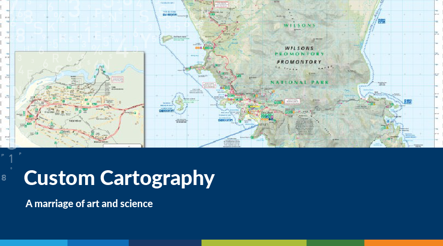 https://spatialvision.com.au/wp-content/uploads/2019/01/Custom-Cartography.png
500
900
Spatial Vision
https://spatialvision.com.au/wp-content/uploads/2020/04/SV_Logo_Inline.png
Spatial Vision2014-01-21 02:53:202023-12-20 14:58:15Custom cartography: A marriage of art and science
https://spatialvision.com.au/wp-content/uploads/2019/01/Custom-Cartography.png
500
900
Spatial Vision
https://spatialvision.com.au/wp-content/uploads/2020/04/SV_Logo_Inline.png
Spatial Vision2014-01-21 02:53:202023-12-20 14:58:15Custom cartography: A marriage of art and science
![]()
![]()
![]()
Shaping Fiji’s Future Geospatial Capability
/in Blog, Climate Change, Climate Change Solutions Page, International Consulting, Strategic Consulting/by Jeff DThrough Spatial Vision’s 2023 Pacific Geospatial Skills Development Program, evidence was sought to support Fiji’s need to enhance their overall geospatial capability to guide development of critical spatial infrastructure, upskill resources, shape policy and provide detailed investment roadmaps.